https://sputnikglobe.com/20170126/weather-satellite-new-earth-photos-1050051166.html
New Weather Satellite Sends Back Breathtaking Pictures of Earth (PHOTOS)
New Weather Satellite Sends Back Breathtaking Pictures of Earth (PHOTOS)
Sputnik International
A new cutting-edge satellite launched by the National Oceanic and Atmospheric Administration (NOAA) has sent back its first ultra-high-resolution photos of... 26.01.2017, Sputnik International
2017-01-26T23:34+0000
2017-01-26T23:34+0000
2017-01-27T04:48+0000
https://cdn1.img.sputnikglobe.com/img/105005/06/1050050689_0:2345:10848:8478_1920x0_80_0_0_6935bb6386ce7ce9bd30c2bd4c5e0d83.jpg
Sputnik International
feedback@sputniknews.com
+74956456601
MIA „Rosiya Segodnya“
2017
Sputnik International
feedback@sputniknews.com
+74956456601
MIA „Rosiya Segodnya“
News
en_EN
Sputnik International
feedback@sputniknews.com
+74956456601
MIA „Rosiya Segodnya“
Sputnik International
feedback@sputniknews.com
+74956456601
MIA „Rosiya Segodnya“
newsfeed, us, latin america, society
newsfeed, us, latin america, society
New Weather Satellite Sends Back Breathtaking Pictures of Earth (PHOTOS)
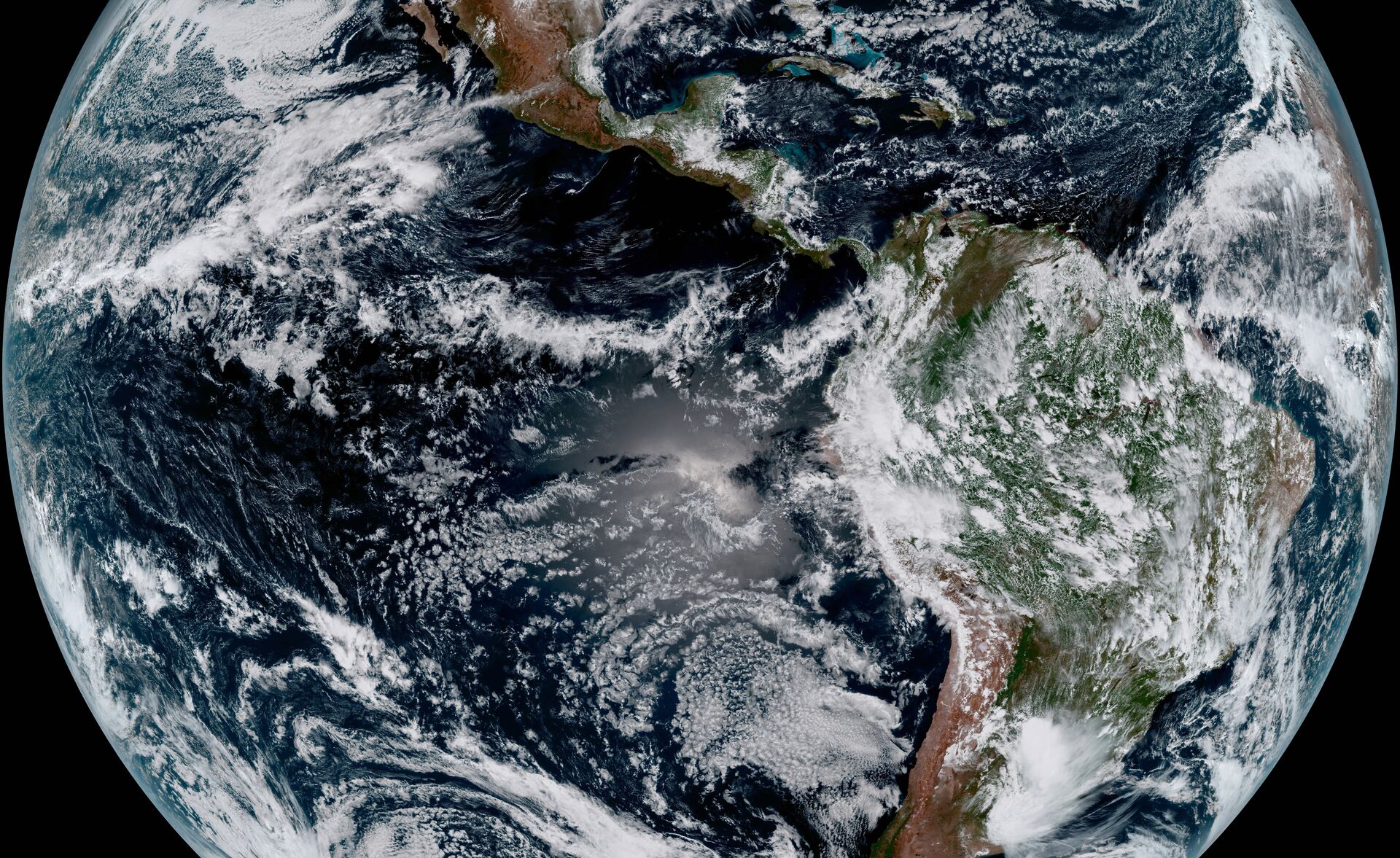
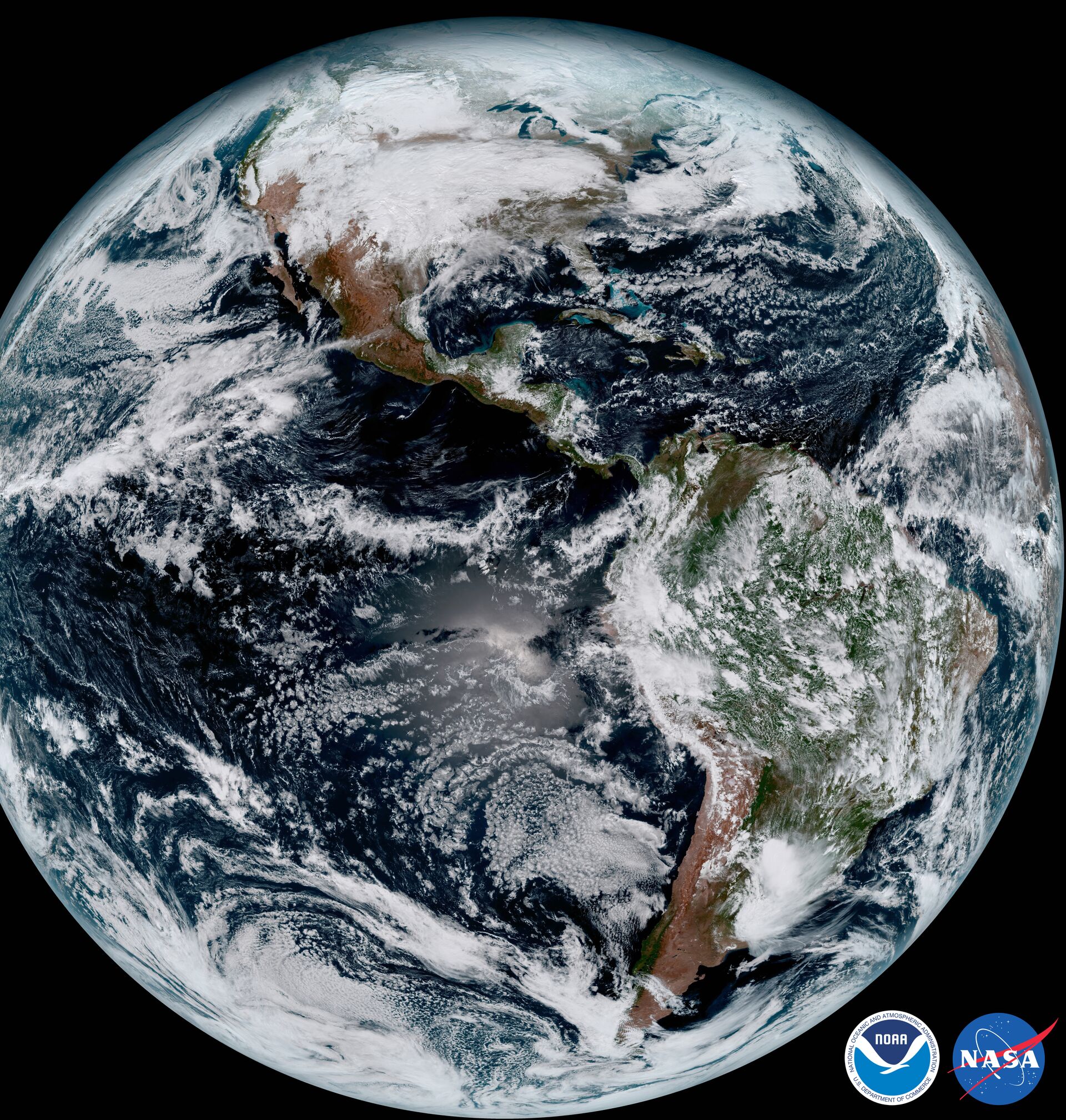
23:34 GMT 26.01.2017 (Updated: 04:48 GMT 27.01.2017) A new cutting-edge satellite launched by the National Oceanic and Atmospheric Administration (NOAA) has sent back its first ultra-high-resolution photos of Earth. GOES-16, launched in November 2016, is described as the most sophisticated weather satellite ever.
The most recent photos, described as "stunning" and "jaw-dropping" by outlets such as Space.com and AccuWeather, feature details like brush fires in Mexico and dust clouds in the Sahara Desert.
The $1.2 billion Geostationary Operational Environmental Satellites (GOES) orbital platform is powerful enough to track lightning with a resolution of a mere 6 miles.
"The release of the first images today is the latest step in a new age of weather satellites. It will be like high-definition from the heavens," according to the NOAA website.
"The higher resolution will allow forecasters to pinpoint the location of severe weather with greater accuracy. GOES-16 can provide a full image of Earth every 15 minutes and one of the continental US every five minutes, and scans the Earth at five times the speed of NOAA's current GOES imagers."
NOAA Director of Satellite and Information Services Stephen Golz said "this is such an exciting day for NOAA! One of our GOES-16 scientists compared this to seeing a newborn baby's first pictures — it's that exciting for us."
GOES-16, launched on November 19, 2016, took its place in orbit two weeks later. Meant to monitor severe weather in the Americas, it is parked in a geostationary orbit, meaning that it stays in the same spot over the surface of the Earth.
GOES-16 is the first of the fourth-generation GOES satellites. The 16 does not refer to the year it launched, but rather because it is the sixteenth GOES satellite. Another GOES will be launched in 2018, and a third in 2019.


