https://sputnikglobe.com/20230307/japan-may-have-7000-more-islands-than-previously-thought-survey-reveals-1108160127.html
Japan May Have 7,000 More Islands Than Previously Thought, Survey Reveals
Japan May Have 7,000 More Islands Than Previously Thought, Survey Reveals
Sputnik International
Japan may soon add more than 7,000 islands to its official list of land holdings. This is double the number found in the last count in 1987, when the technology could not distinguish small clusters of islands.
2023-03-07T22:19+0000
2023-03-07T22:19+0000
2023-03-07T22:25+0000
asia
japan
island
coast
japan coast guard
https://cdn1.img.sputnikglobe.com/img/103554/23/1035542379_0:206:4001:2456_1920x0_80_0_0_e3514048be1b3b4445d9bd10b9c7ce9f.jpg
Japan may soon add more than 7,000 islands to its official list of land holdings, effectively doubling its last tally from 1987.According to previous data, there were a total of 6,852 islands, of which only 260 were inhabited. But a new analysis using aerial photographs, existing maps and other data revealed a total of 14,125 islands.The reason for the discrepancy is quite simple: when the Japanese Coast Guard counted the islands 35 years ago, the technology could not distinguish small clusters of islands from larger individual islands, which meant that thousands of these islands were considered as one whole.In addition, since then, volcanic eruptions have also contributed to the formation of new islands, which together have almost doubled the island territory that Japan previously considered.To calculate the number of islands, scientists in Japan marked only those with a circumference of 100 meters or more and which are natural formations. The same calculation methods were used to confirm Japan's territory, but the Geospatial Information Authority of Japan (GSI) added the use of aerial photographs and checked the results against past maps to make sure they did not include artificially reclaimed land.However, "the results of this survey will not affect Japan's territory and territorial waters," GSI explained in a statement.Japan has therefore decided to make use of modern digital mapping technology to gain a more accurate picture of the land masses scattered across it.In one instance the small island of Esanbe Hanakita Kojima was recently destroyed by storms and ice drifts; however, the loss might have gone unnoticed if the island had not marked the disputed western edge of the country's territory.
japan
Sputnik International
feedback@sputniknews.com
+74956456601
MIA „Rosiya Segodnya“
2023
News
en_EN
Sputnik International
feedback@sputniknews.com
+74956456601
MIA „Rosiya Segodnya“
Sputnik International
feedback@sputniknews.com
+74956456601
MIA „Rosiya Segodnya“
japan, new japanese islands, japan found thousands of new islands how, esanbe hanakita kojima, territory of japan
japan, new japanese islands, japan found thousands of new islands how, esanbe hanakita kojima, territory of japan
Japan May Have 7,000 More Islands Than Previously Thought, Survey Reveals
22:19 GMT 07.03.2023 (Updated: 22:25 GMT 07.03.2023) Despite recent findings indicating that the island nation has thousands of previously undetected land masses, the number of square kilometres of Japanese territory will not be affected by the new data.
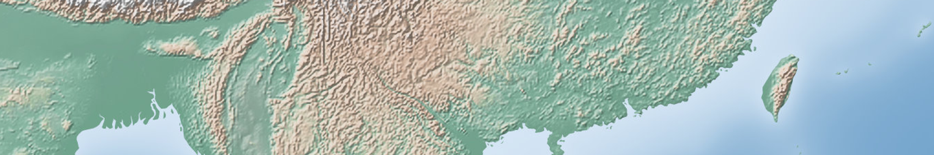
Japan may soon add more than 7,000 islands to its official list of land holdings, effectively doubling its last tally from 1987.
According to previous data, there were a total of 6,852 islands, of which only 260 were inhabited. But a new analysis using aerial photographs, existing maps and other data revealed a total of 14,125 islands.
The reason for the discrepancy is quite simple: when the Japanese Coast Guard counted the islands 35 years ago, the technology could not distinguish small clusters of islands from larger individual islands, which meant that thousands of these islands were considered as one whole.
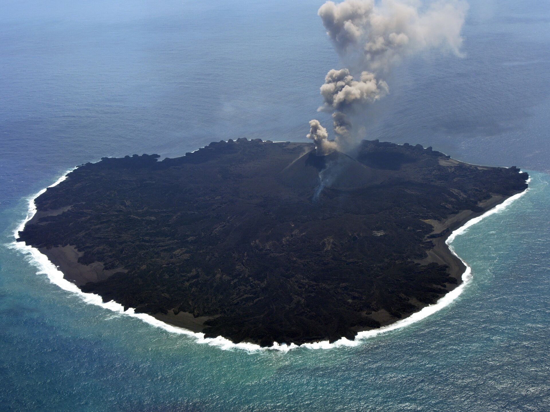
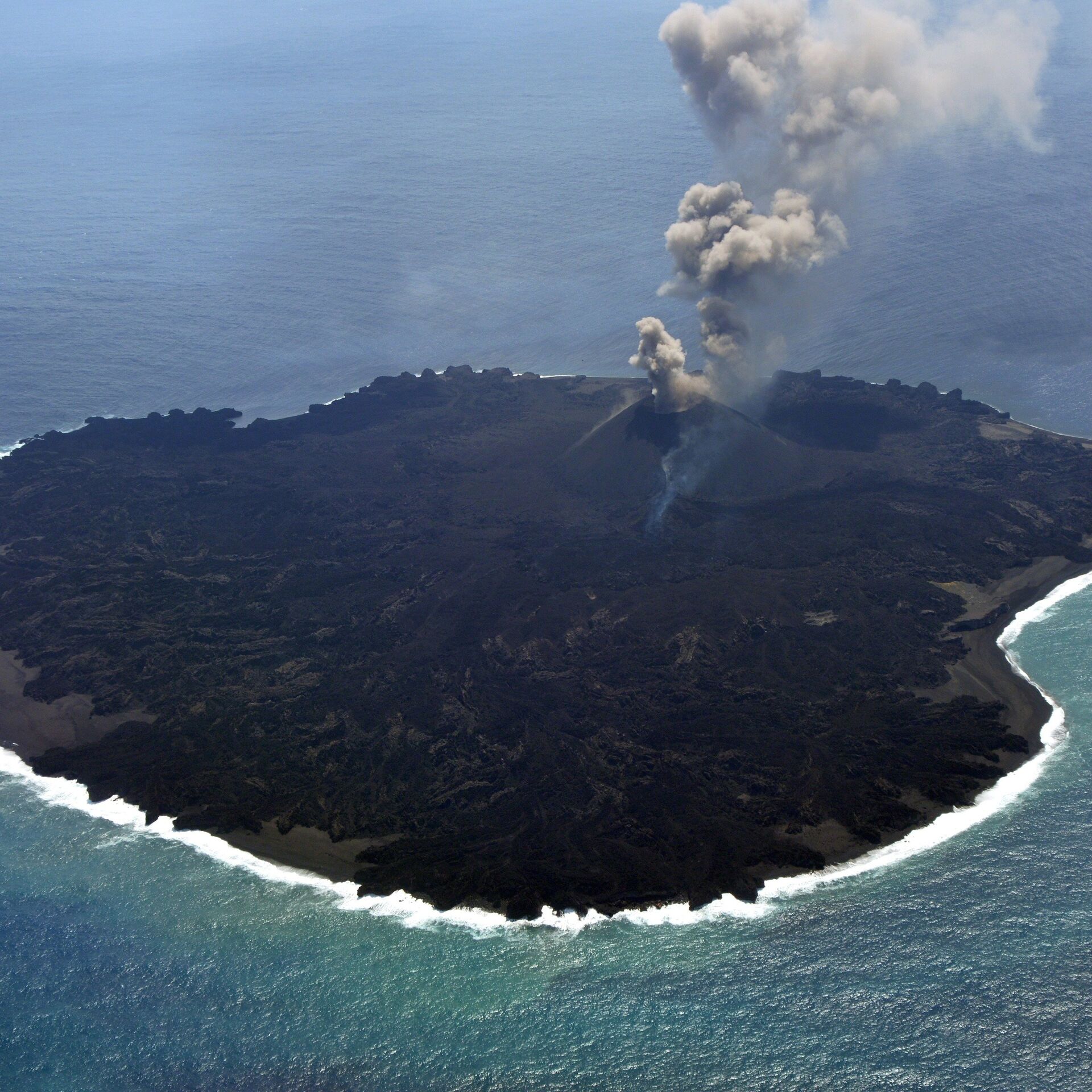
In addition, since then, volcanic eruptions have also contributed to the formation of new islands, which together have almost doubled the island territory that Japan previously considered.
To calculate the number of islands, scientists in Japan marked only those with a circumference of 100 meters or more and which are natural formations. The same calculation methods were used to confirm Japan's territory, but the Geospatial Information Authority of Japan (GSI) added the use of aerial photographs and checked the results against past maps to make sure they did not include artificially reclaimed land.
However, "the results of this survey will not affect Japan's territory and territorial waters," GSI explained in a
statement.
Japan has therefore decided to make use of modern digital mapping technology to gain a more accurate picture of the land masses scattered across it.
"An accurate understanding of the number of islands is an important administrative matter that is related to the national interest," a lawmaker from the incumbent Liberal Democratic Party said earlier.
In one instance the small island of Esanbe Hanakita Kojima was recently destroyed by storms and ice drifts; however, the loss might have gone unnoticed if the island had not marked the disputed western edge of the country's territory.


