
Russian Island ‘Blurred’ by Google Maps Triggers Wild Conspiracy Theories About Secret Military Base
13:34 GMT 18.08.2021 (Updated: 20:26 GMT 19.10.2022)

CC0 / /
Subscribe
A number of places on Google Maps have been “obscured” intentionally, with some reasons self-evident, as in the case of air bases or missile silos. Nevertheless, these instances never fail to feed into the frenzy of speculation by users.
The discovery by users that a remote piece of icy landmass belonging to Russia appears to be “censored” on Google Maps has set off a wealth of conspiracy theories.
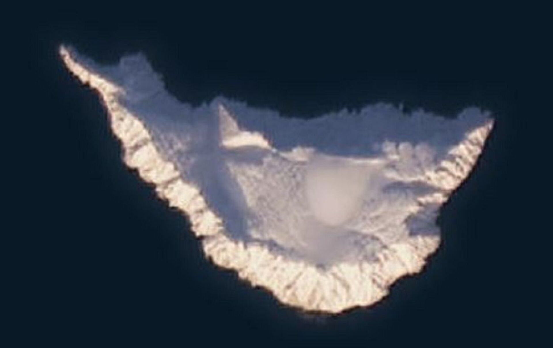
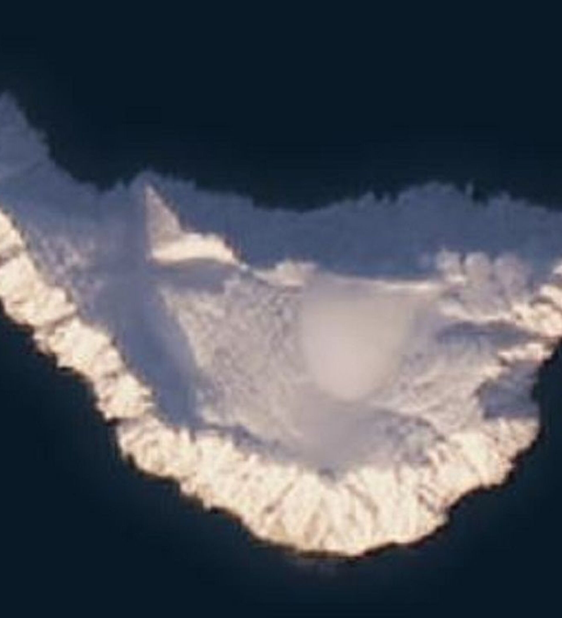
Jeannette Island, measuring just 1.2 square miles or around three square kilometres in length, is part of the De Long Island archipelago in the East Siberian Sea. It is shown as an ominous black smudge on the digital map tool, according to images provided to Google by The International Bathymetric Chart of the Arctic Ocean.
The IBCAO initiative, set up in 1997, aims to develop a digital data base that contains all available bathymetric data north of 64° North. With the ultimate aim of mapping the global seafloor by 2030, in 2017, IBCAO merged its efforts with the Nippon Foundation-GEBCO-Seabed 2030 Project.
The search giant has not commented on the issue.
However, conspiracy theories have had a field day with the discovery, with suggestions ranging from the black blob possibly concealing a secret Russian military base, radar or naval station to the island being inhabited by aliens.
On Reddit, one user, going by the name of exoplanetaryscience, wrote:
"Google rarely blacks out without reason. A search through google earth shows that this has been permanently blurred out- even in images dating back to the 1980s… I'm going to guess there's a concealed Russian military base located there, and possibly quite a substantial one at that."
Icy Landmass with Intriguing History
Jeannette Island was discovered in 1881 during an expedition led by American Navy officer and explorer George E. De Long, as part of an unsuccessful effort to reach the North Pole through the Bering Strait.
De Long had found himself trapped in thick ice near Herald Island and while drifting, approached Jeanette Island. The explorers took shelter on the uninhabited island, named it after their ship, the USS Jeanette, and took possession of the landmass in the name of the United States.
However, following the Imperial Arctic Ocean Hydrographic Expedition of 1910–1915, Russia publicly announced that Jeanette, along with other Arctic islands, was its territory.
The US government did not contest the claim regarding the island, which now administratively belongs to the Sakha Republic of the Russian Federation.
Jeanette Island appears with a similar blurred effect on Google Earth, while it is visible in the low-resolution satellite imagery of the area on other sites, such as Bing Maps, according to investigative journalism website Bellingcat.
Landsat 8 satellite imagery (via Sentinel Hub Playground) purportedly shows Jeannette Island matching the photographs of it uploaded onto social networks.
Beautiful Jeannette Island… waiting to be explored by us… our expedition should be able to contribute to its cartography pic.twitter.com/nVu2xkU6yQ
— Luc Hardy (@luchardy) September 25, 2017
Luc with Prof. Eric Crubezy and Alexeï Tikhonov (r.) on top of Jeannette Island in the East Siberian Sea #paxarctica pic.twitter.com/M2tYszu9pu
— Luc Hardy (@luchardy) September 23, 2017
Today Wednesday, on Bennett Island, somewhere in the Russian Arctic. Very cold, windy, but magical #paxarctica pic.twitter.com/KqlqnXBGfC
— Luc Hardy (@luchardy) September 20, 2017
Photos of an expedition to the East Siberian Sea islands, including Jeannette, were uploaded during the Pax Arctica, a Russian Arctic expedition led by explorer Luc Hardy.
.


