

The National Hurricane Center forecasts Category 4 Hurricane Matthew will make a direct strike on the West Coast of Haiti near the city Les Cayes Late Monday Night, early Tuesday morning with the saving grace for the island nation being that the storm is expected to strike after high-tide slightly minimizing what is expected to be catastrophic damage with the country laced with unconventional and unsteady building structures after it failed to rebuild after the 2010 Earthquake.
A slight deviation in Hurricane Matthew’s path may take the hurricane through the windward pass between Jamaica and Haiti potentially sparing the country of the tropical cyclone’s strongest winds, but the storm likely represents a horrendous threat for loss of life due to the massive storm surge, heavy rains, and slow motions creating a lethal risk of mass flooding and lethal landslides.
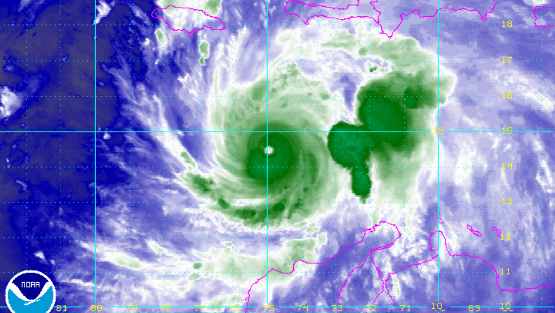
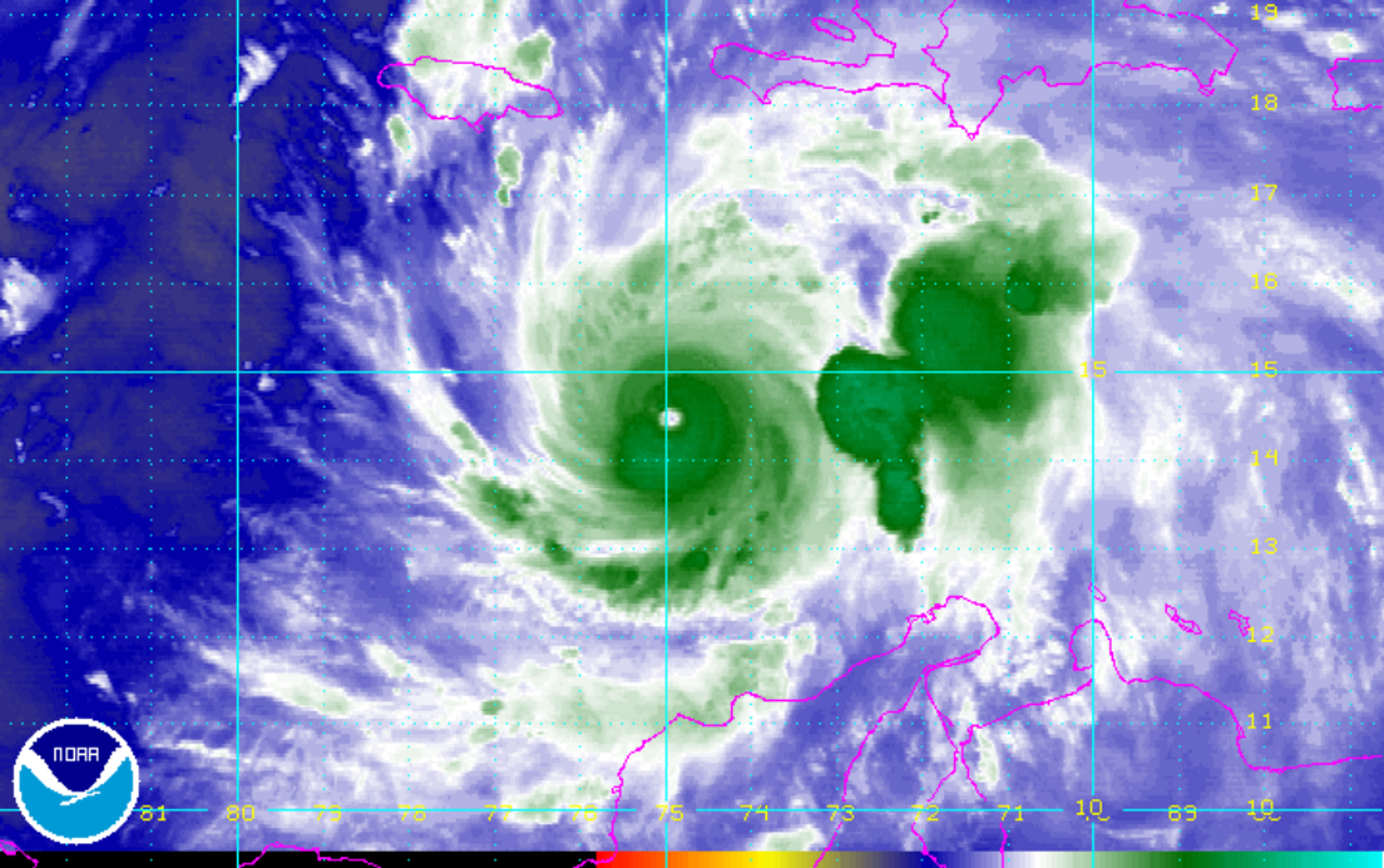
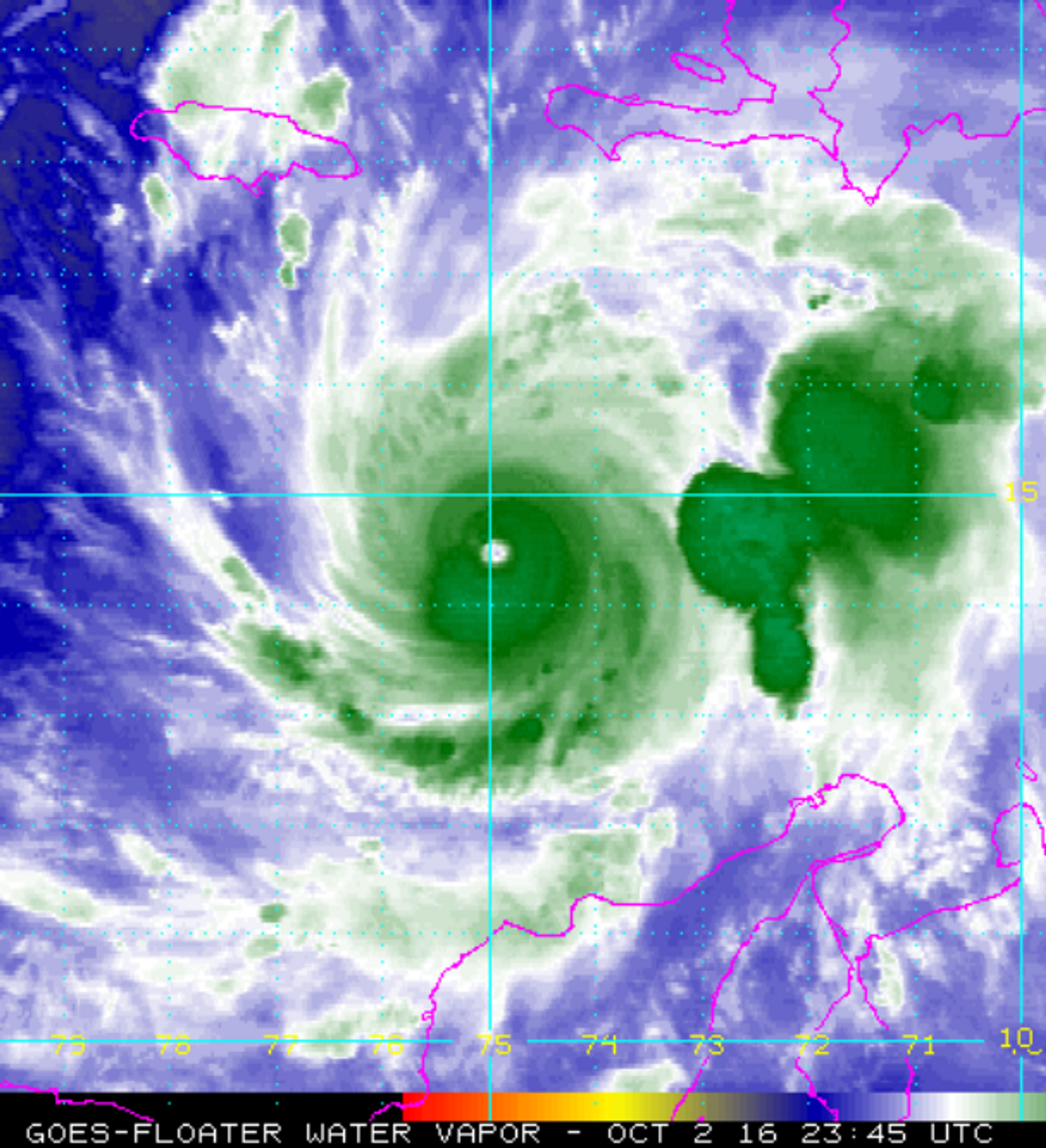
As of the 5PM EDT advisory Hurricane Matthew boasted winds of 145MPH with a minimum pressure of 945 millibars (MB) while boasting wind gusts of 170MPH. The storm was seen tracking off to the Northwest at 4 MPH with a slow rate of movement expected at the time of landfall worsening the storm’s impacts.
The storm’s unconventional formation with a large "blob" – as befuddled top US Hurricane expert Jeff Masters called the rampant batch of deep thunderstorm convection along the storm’s northwestern flank – further complicates the expected impacts on Haiti which will face similar rainfall totals of 40 inches regardless of whether the storm moves slightly West of the country.
In a website post this afternoon for the meteorological forecasting website Weather Underground, Masters noted that the storms slightly more westerly trajectory amplifies the risk of the storm making US landfall with the National Hurricane Center’s five-day warning cone now centering the storm directly into the Carolina’s with landfall predicted next Friday or Saturday.
It is important for people along the East Coast, including even Southern Florida, to pay close attention to this tropical cyclone despite falling outside of Hurricane Matthew’s three and five day forecast cone given the storm’s recent wobble to the West just slightly off the forecast path placing the storm at coordinates of 14.8 N and 75W. The storm also continues to threaten, albeit at a lower risk percentage, a direct impact on the island of Jamaica should it continue along its current trajectory.
Hurricanes fall outside of the National Hurricane Center’s warning cone 33% of the time so its close location to islands throughout the Caribbean and the southern continental United States warrants close observation for potential track changes. South Florida, in particular, should keep an eye on the storm which with potential landfall, in the event of a slight changes in direction, only 72 hours away.


