
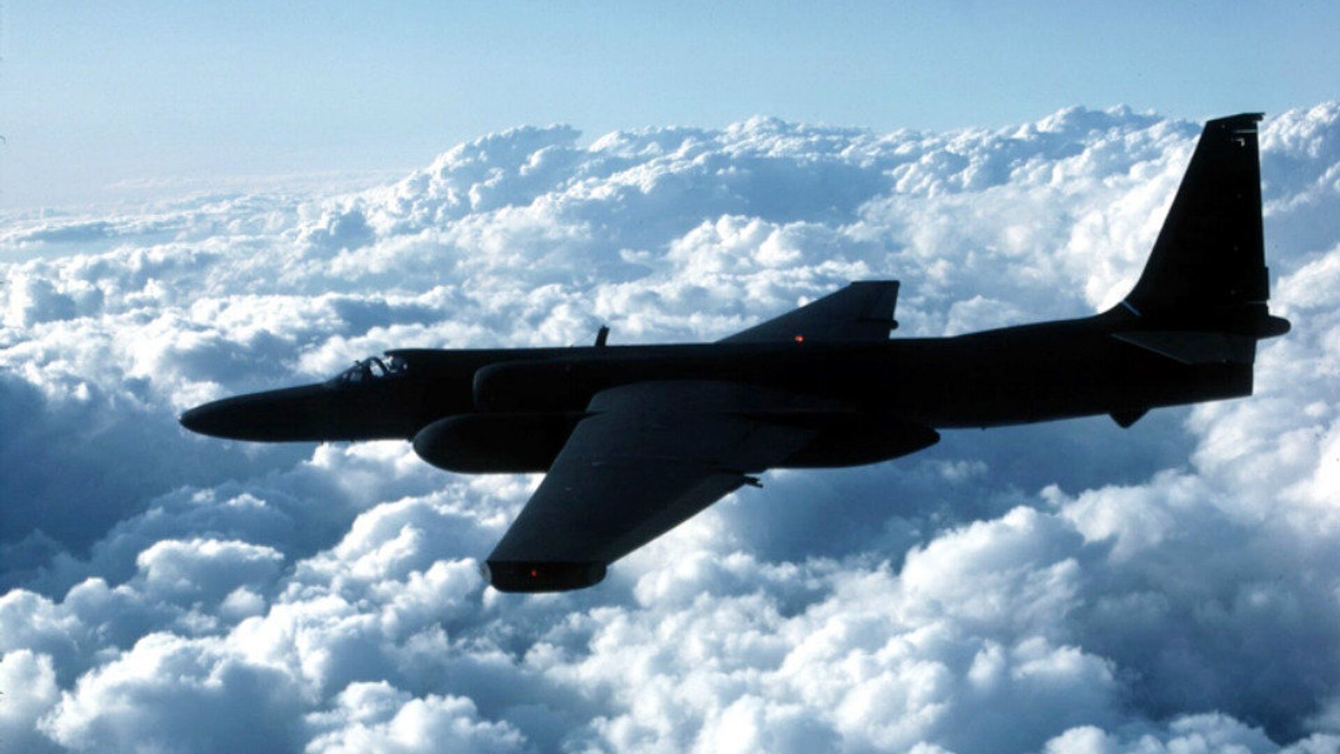
When the Air Force’s U-2 “Dragon Lady” spy plane pilots fly on their dizzying, high-altitude missions around the globe, they take with them equipment capable of hijacking the navigational networks of the very countries they’re spying on, a leading US general has revealed.
“My U-2 guys fly with a watch now that ties into GPS, but also BeiDou and the Russian [GLONASS] system and the European [Galileo] system so that if somebody jams GPS, they still get the others,” said Air Combat Command chief Gen. James M. Holmes on Wednesday at a conference in Washington, DC. The remarks were made in response to a question about the Pentagon’s addition of redundancies into its equipment, Defense One reported.
Holmes was short on details, but Defense One noted the Air Force bought 100 Garmin D2 Charlie navigational watches for its U-2 pilots in 2018.
“The D2 Charlie aviator watch will be an integral and functional part of the U-2 pilot’s toolkit,” the company said in a February 2018 news release.
“Designed with pilots of varying backgrounds and missions, the D2 Charlie aviator watch features a colorful, dynamic moving map which depicts airports, navaids, roads, bodies of water, cities and more, offering greater situational awareness,” the company said. “When the D2 Charlie is paired with Garmin Connect on a connected mobile device, pilots can view weather radar on top of the map display relative to flight plan information.”
However, interest in the ability to tap into different navigational satellite networks is hardly restricted to the Pentagon: studies in 2010 and 2012 noted the practical benefits of being able to reference Russia’s 24 GLONASS satellites and the European Union’s 30 Galileo satellites for quicker and more accurate location data in the event that a direct line of sight to a GPS satellite is blocked, as can happen in urban environments The US operates 31 GPS satellites under the purview of the US Space Force.
“Inclusion of GLONASS observations does offer some significant advantages over GPS-only integrated systems. Although not quantified here, similar results would also be expected by including data from other GNSS [Global Navigation Satellite Systems] as well (e.g., Galileo),” a 2012 study published in the journal Sensors concluded.
China also operates a global navigation satellite system, BeiDou, which consists of two constellations totaling 33 satellites.


