

In a study conducted by Imperial College London, researchers found a "chance series" of geological events accounts for the country's current geographic position. If it wasn't for these cataclysms, Britain, Europe and the world would likely be very different today.
#Brexit 1.0: Scientists find evidence of Britain's separation from Europe 450,000 yrs ago (Play and listen) https://t.co/CFmBjurtjC pic.twitter.com/5CaTM11Kv8
— Imperial College (@imperialcollege) April 4, 2017
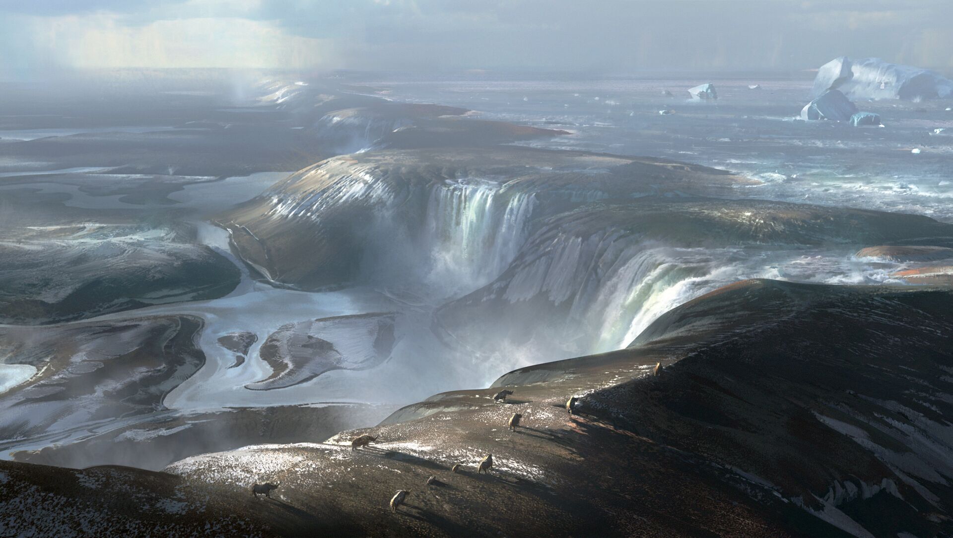
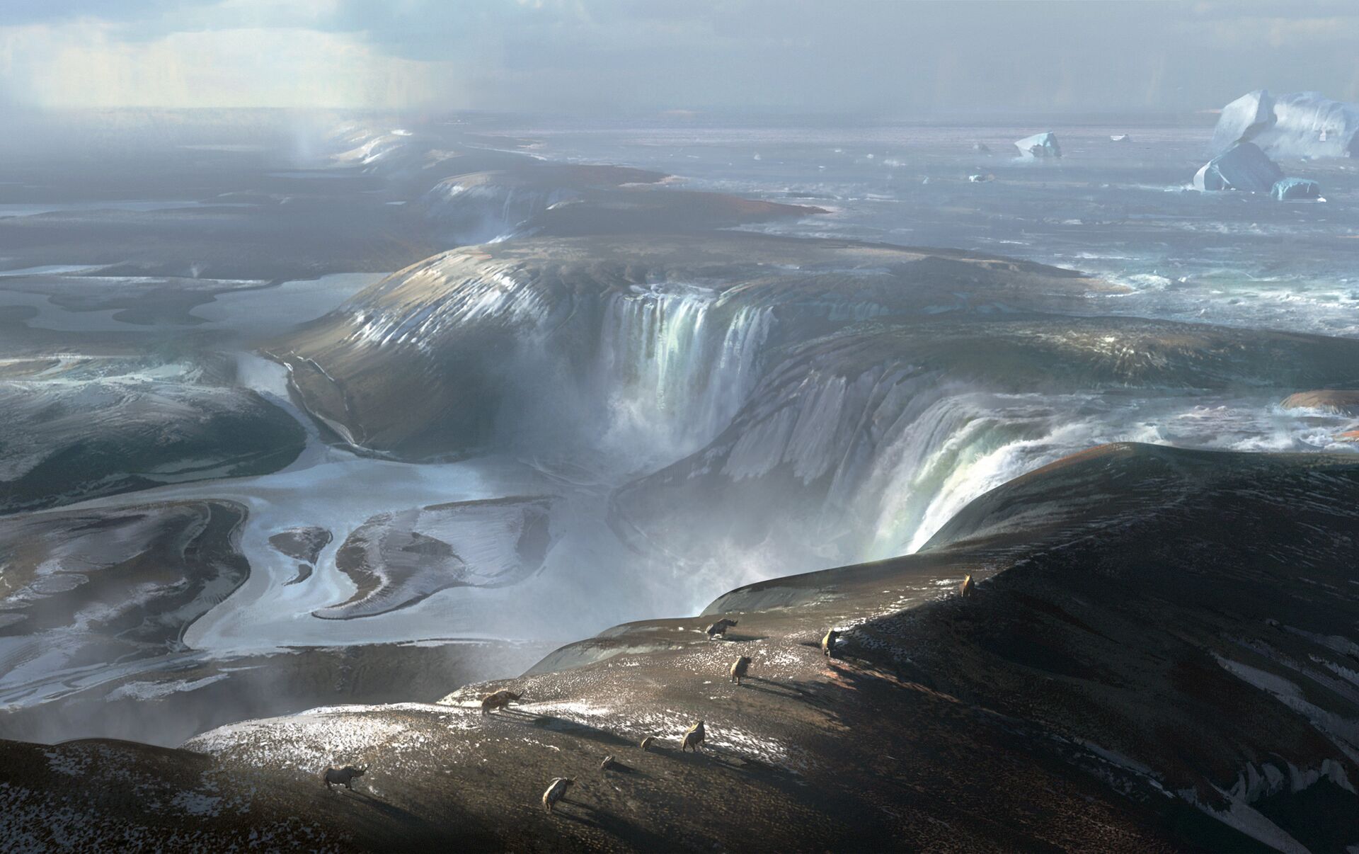
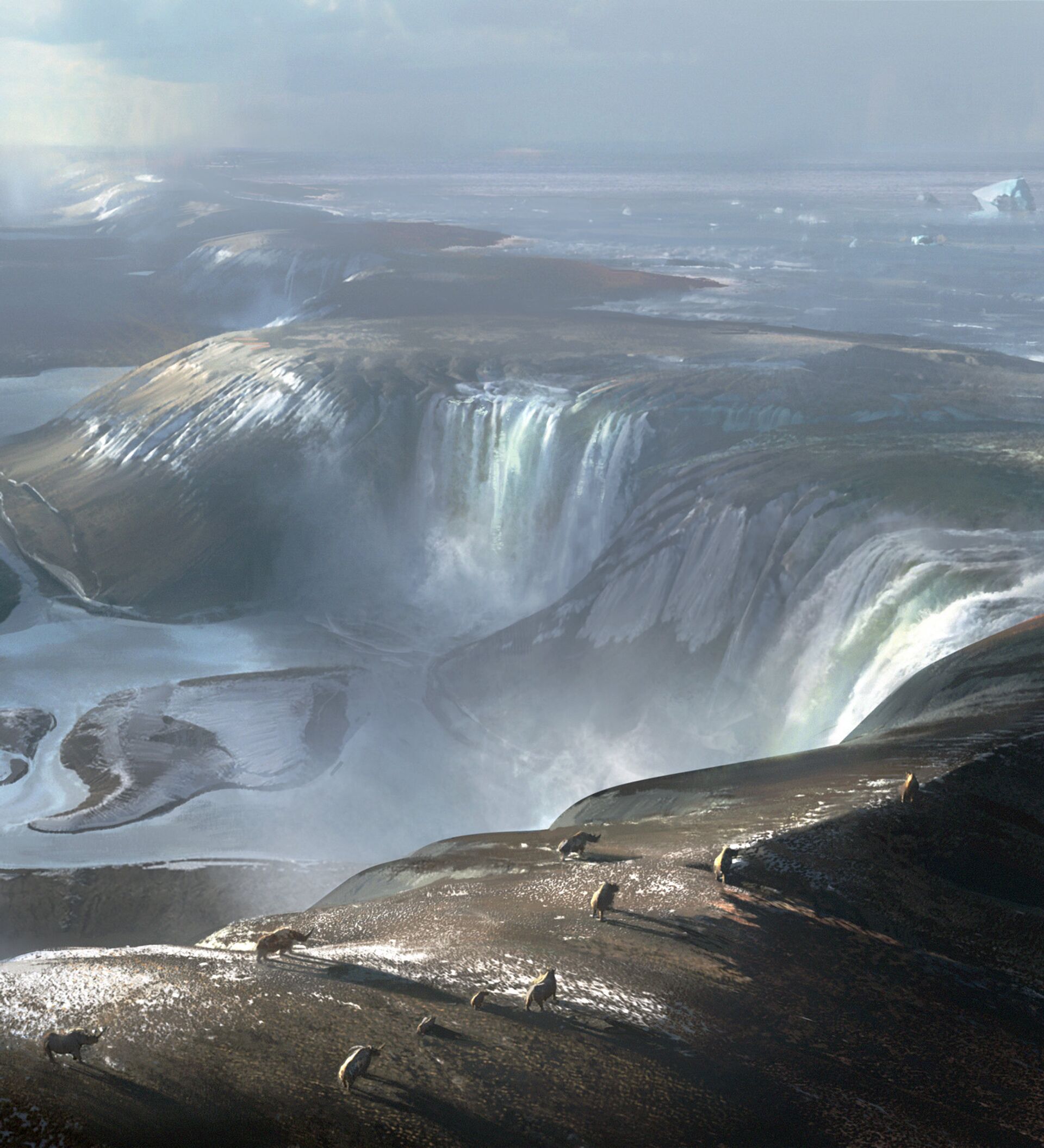
Roughly 450,000 years ago, the UK was connected to France by a rocky ridge, approximately 32 kilometers long, behind which lay a great lake dotted with icebergs, with ice stretching across what is now the North Sea. What is now the English Channel would have been dry, save for some small rivers, while the surrounding land would have been barren and grey, resembling the bleak straits of Siberia.
However, at some point the ridge began to flood, in turning creating massive waterfalls that sliced through the rock ridge and created the Dover Strait.
The research, led by Professor Sanjeev Gupta of Imperial College's Department of Earth Science and Engineering, draws together a number of long-held theories and previous studies of the Channel's seafloor. It used new, high resolution mapping of the landscape under the sea of the Dover Strait to determine how Britain separated from France. Previously, details of the grand breakup had only been guessed at.
"We found these huge holes eroded into the bedrock in the Dover strait, and we believe the best explanation for these is these were giant plunge pools — formed by waterfalls from the lake water plunging over [the ridge]," Professor Gupta said.
The sediment-filled holes are enormous reaching up to 140 meters in depth and up to four kilometers in diameter, in a line running across the seafloor. They were first discovered decades ago, leading to a change in the Channel Tunnel route, although an explanation for their existence had hitherto proved elusive.
Prof Sanjeev Gupta @imperialcollege co-author of Brexit 1.0 study — Britain's ice age split from Europe pic.twitter.com/ksS8f9ugw8
— Matthew Stock (@MattReuters) April 5, 2017
Erosion of the ridge partially ruptured the dam-like structure, releasing pent-up lake water which possibly carved some of the valleys previously found in the center of the Channel.
However, it would take further events for the British Isles' destiny as an archipelago to be cemented — the team's data revealed details of a huge valley, etched into the seafloor, running from behind the location of the former rock ridge into the Channel, cutting across the fossil plunge pools and connecting with the valleys in the center of the Channel.
Live images from the channel tunnel… #brexitday pic.twitter.com/Gaom6UGClg
— PaulMCFC16 ✌ (@Paulmcfc18) March 29, 2017
That, Gupta suggests, was formed by flooding, possibly around 160,000 years ago during another glacial period, and together the two stages completely opened up the Dover strait.
Britain probably only became a fully-fledged island about 125,000 years ago, after further sea level rises were produced by a warming climate.
Brexit 1.0 was evidently a violent and protracted process, just as Brexit 2.0 could well end up being.
Despite the seismic findings, the team as yet has no definitive timeline of events, so now wish to collect and analyze core samples of the plunge pools' in-filled sediments to try and pinpoint the timing of erosion and the filling of the pools.


