https://sputnikglobe.com/20220821/new-evidence-possibly-backing-story-of-welsh-atlantis-found-in-britain-1099831912.html
New Evidence Possibly Backing Story of 'Welsh Atlantis' Found in Britain
New Evidence Possibly Backing Story of 'Welsh Atlantis' Found in Britain
Sputnik International
Evidence for the likely existence of a now-sunken pair of islands off the coast of Wales comes from a Late Medieval map of the British Isles, as well as from... 21.08.2022, Sputnik International
2022-08-21T19:10+0000
2022-08-21T19:10+0000
2023-05-28T15:20+0000
world
wales
map
evidence
united kingdom (uk)
https://cdn1.img.sputnikglobe.com/img/07e6/08/15/1099832746_14:0:2034:1136_1920x0_80_0_0_89a06fa767980842c93728b4e20e95fc.jpg
Scholars in the UK have stumbled upon evidence that may corroborate the story of Cantre'r Gwaelod, a legendary sunken kingdom often referred to as the Welsh Atlantis and that supposedly occupied a tract of land located in what is now Cardigan Bay to the west of Wales.According to the BBC, the evidence in question comes in the form of a medieval map that depicts two islands off the Ceredigion coast, “each about a quarter the size of Anglesey,” which apparently no longer exist.Simon Haslett, honorary professor of physical geography at Swansea University who presented the evidence together with David Willis, Jesus Professor of Celtic at the University of Oxford, said that both islands are clearly marked on the so-called Gough Map, a Late Medieval map that may be the earliest surviving complete one of the British Isles.As Haslet explained, the evidence for the islands, and possibly the legends related to them, “is in two strands.”"Firstly, coordinates recorded by the Roman cartographer Ptolemy suggest that the coastline at the time may have been some 13km (8 miles) further west than it is today,” he said. "And, secondly, the evidence presented by the Gough Map for the existence of two islands in Cardigan Bay."He also suggested that legends about people being able to walk between lands that have since become separated by the sea may have originated in folk memory about rising sea levels in the wake of the last ice age, the media outlet notes."However, legends of sudden inundation, such as in the case Cantre'r Gwaelod, might be more likely to be recalling sea floods and erosion, either by storms or tsunami, that may have forced the population to abandon living along such vulnerable coasts," Haslet added.
https://sputnikglobe.com/20191119/atlantis-is-calling-top-8-sunken-cities-and-watery-landmarks-that-actually-exist-1077352355.html
wales
united kingdom (uk)
Sputnik International
feedback@sputniknews.com
+74956456601
MIA „Rosiya Segodnya“
2022
News
en_EN
Sputnik International
feedback@sputniknews.com
+74956456601
MIA „Rosiya Segodnya“
Sputnik International
feedback@sputniknews.com
+74956456601
MIA „Rosiya Segodnya“
wales, map, evidence, united kingdom (uk)
wales, map, evidence, united kingdom (uk)
New Evidence Possibly Backing Story of 'Welsh Atlantis' Found in Britain
19:10 GMT 21.08.2022 (Updated: 15:20 GMT 28.05.2023) Evidence for the likely existence of a now-sunken pair of islands off the coast of Wales comes from a Late Medieval map of the British Isles, as well as from data recorded by a Roman cartographer.
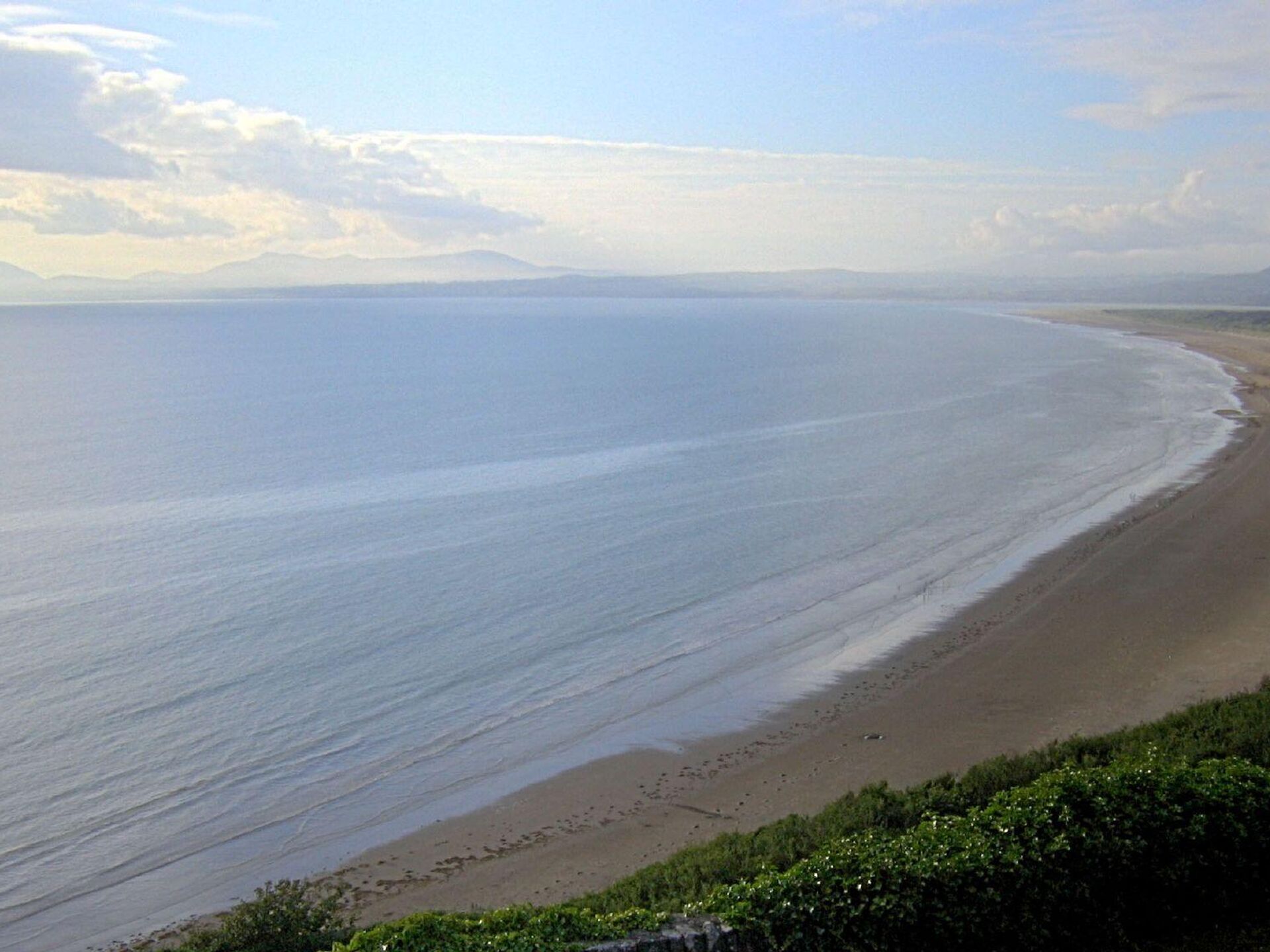
Scholars in the UK have stumbled upon evidence that may corroborate the story of Cantre'r Gwaelod, a legendary sunken kingdom often referred to as the Welsh Atlantis and that supposedly occupied a tract of land located in what is now Cardigan Bay to the west of Wales.
According to the BBC, the evidence in question comes in the form of a medieval map that depicts two islands off the Ceredigion coast, “each about a quarter the size of Anglesey,” which apparently no longer exist.
Simon Haslett, honorary professor of physical geography at Swansea University who presented the evidence together with David Willis, Jesus Professor of Celtic at the University of Oxford, said that both islands are clearly marked on the so-called Gough Map, a Late Medieval map that may be the earliest surviving complete one of the British Isles.
"The Gough Map is extraordinarily accurate considering the surveying tools they would have had at their disposal at that time," Haslett said. "The two islands are clearly marked and may corroborate contemporary accounts of a lost land mentioned in the Black Book of Carmarthen."
As Haslet explained, the evidence for the islands, and possibly the legends related to them, “is in two strands.”
"Firstly, coordinates recorded by the Roman cartographer Ptolemy suggest that the coastline at the time may have been some 13km (8 miles) further west than it is today,” he said. "And, secondly, the evidence presented by the Gough Map for the existence of two islands in Cardigan Bay."

19 November 2019, 17:30 GMT
He also suggested that legends about people being able to walk between lands that have since become separated by the sea may have originated in folk memory about rising sea levels in the wake of the last ice age, the media outlet notes.
"However, legends of sudden inundation, such as in the case Cantre'r Gwaelod, might be more likely to be recalling sea floods and erosion, either by storms or tsunami, that may have forced the population to abandon living along such vulnerable coasts," Haslet added.


