2022 Pacific Hurricane Season: Agatha Makes Landfall in Mexico as Models Predict Florida Impact

© AFP 2023 / GIL OBED
Subscribe
Above-average hurricane activity is expected again this season, making it the sixth straight year of above-average hurricane activity, according to records. Forecasters say there's a 65% chance of an above-normal season, a 25% chance of a near-normal season, and a 10% probability of a below-normal season.
Hurricane Agatha, the strongest May hurricane to hit the region on record, made landfall on Mexico's southern coast on Monday, only days before the official start of the 2022 hurricane season, according to forecasts at the US National Hurricane Center (NHC).
According to the NHC, Agatha was recorded making landfall as a severe Category 2 storm around 5 miles (10 kilometers) west of Puerto Angel, with maximum sustained winds of 105 mph (165 kph). It was traveling northeast at a speed of 8 miles per hour (13 kph).
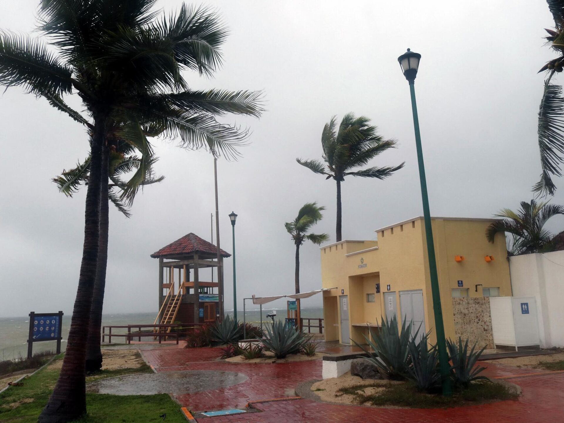
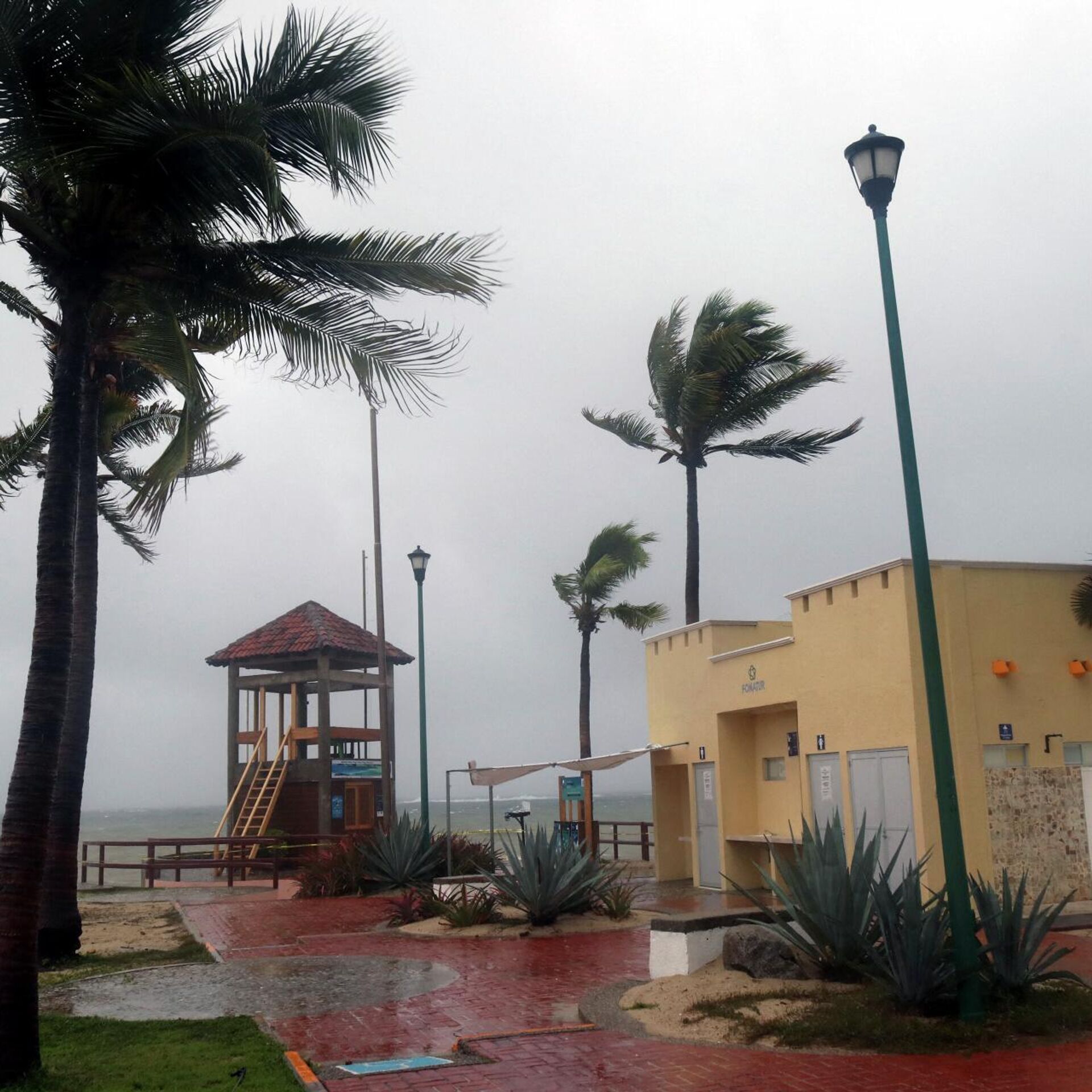
Wind gusts, heavy rain, and large waves pounded the coastal town of Zipolite, which has long been famed for its clothing-optional beach and bohemian feel, according to the Associated Press.
In general, reports from the area of the storm's rainfall have indicated that it whipped palm trees and drove tourists and residents into shelters in a region that is sparsely populated save for a few small settlements along the coast, all thanks to torrential rains and howling winds.
Notably, Agatha is the first named storm of the 2022 Pacific season, which typically lasts from June 1 until November 30 each year.
Breaking: Hurricane Agatha has made landfall in Oaxaca, Mexico, just west of Puerto Angel. https://t.co/I2bjCNdUXS pic.twitter.com/QPv4i1RFrF
— Breaking Weather by AccuWeather (@breakingweather) May 30, 2022
After the storm passes over Mexico, several forecast models predict that the storm's remnants may hit the southern part of Florida.
According to the NHC, Agatha, which is currently raging as a Category 2 storm, is already the biggest storm to make landfall in May along Mexico's Pacific coast since records began in 1949.
4pm CDT 30 May - #Hurricane #Agatha has made landfall just west of Puerto Angel, Mexico, with maximum sustained winds of 105 mph.
— NHC Eastern Pacific (@NHC_Pacific) May 30, 2022
Since record keeping began in 1949, this is the strongest hurricane to make landfall in May along the Pacific coast of Mexico. pic.twitter.com/dUraseRoDe
Agatha could redevelop into the Atlantic basin's first named storm when it passes Mexico and hits the Bay of Campeche in the coming days, according to AccuWeather meteorologists, cited by the Naples Daily News. Alex would be the name of the storm if it forms.
In the coming days, an area of low pressure is projected to develop throughout Central America, the Yucatan Peninsula, and the southwest Gulf of Mexico, owing in part to the eastern Pacific remnants of Hurricane Agatha.
Last week, the National Oceanic and Atmospheric Administration (NOAA) predicted 14 to 21 named storms in the near future. Tropical storms with wind speeds of 39 mph (62 kph) or higher are included in these figures. When winds hit 74 mph (119 kph), storms become hurricanes.


