https://sputnikglobe.com/20220507/antarctic-ice-sheet-may-be-hiding-earths-largest-groundwater-reservoir-scientists-say-1095333758.html
Antarctic Ice Sheet May Be Hiding Earth's Largest Groundwater Reservoir, Scientists Say
Antarctic Ice Sheet May Be Hiding Earth's Largest Groundwater Reservoir, Scientists Say
Sputnik International
Scientists might be getting closer to an understanding of how the Antarctica and its underground waters are responding - or even contributing - to climate... 07.05.2022, Sputnik International
2022-05-07T13:34+0000
2022-05-07T13:34+0000
2022-05-07T13:34+0000
science & tech
antarctic
climate change
https://cdn1.img.sputnikglobe.com/img/07e6/05/07/1095333842_0:131:2500:1537_1920x0_80_0_0_7d7b4772efbb3c713c9b17ca96df740c.jpg
Over the course of recent years, scientists have discovered a network of rivers and lakes that exist within the Antarctic ice, while also imaging thick basins of sediments under the ice that could potentially contain the biggest water reservoir on the planet, according to a new study.The findings resulted in scientists piecing together a huge map of the groundwater system in deep sediments in West Antarctica. Such systems may indicate the continent's response to climate change, or even how it might contribute to it.Before the study, evidence pointing to the fact that there is a massive groundwater reservoir below the Antarctic ice had been quite elusive. But the new findings seem to have changed the picture.In order to map the groundwater systems in Antarctica, the researchers behind the study used magnetotelluric and passive seismic data from the Whillans Ice Stream of West Antarctica. The technique of magnetotelluric imaging measures the penetration into the earth of natural electromagnetic energy generated high in the planet’s atmosphere. Ice, sediments, salty water and other things emanate different types of such energy, so, having measured the differences, one could create MRI-like maps of various elements."This groundwater, extending downward for more than a kilometre, contains more than 10 times as much fluid volume as the shallow hydrologic system above and actively exchanges with it. Therefore, it has the potential to modulate ice streaming and subglacial biogeochemical reactions," the study's abstract notes.
antarctic
Sputnik International
feedback@sputniknews.com
+74956456601
MIA „Rosiya Segodnya“
2022
Sputnik International
feedback@sputniknews.com
+74956456601
MIA „Rosiya Segodnya“
News
en_EN
Sputnik International
feedback@sputniknews.com
+74956456601
MIA „Rosiya Segodnya“
Sputnik International
feedback@sputniknews.com
+74956456601
MIA „Rosiya Segodnya“
science & tech, antarctic, climate change
science & tech, antarctic, climate change
Antarctic Ice Sheet May Be Hiding Earth's Largest Groundwater Reservoir, Scientists Say
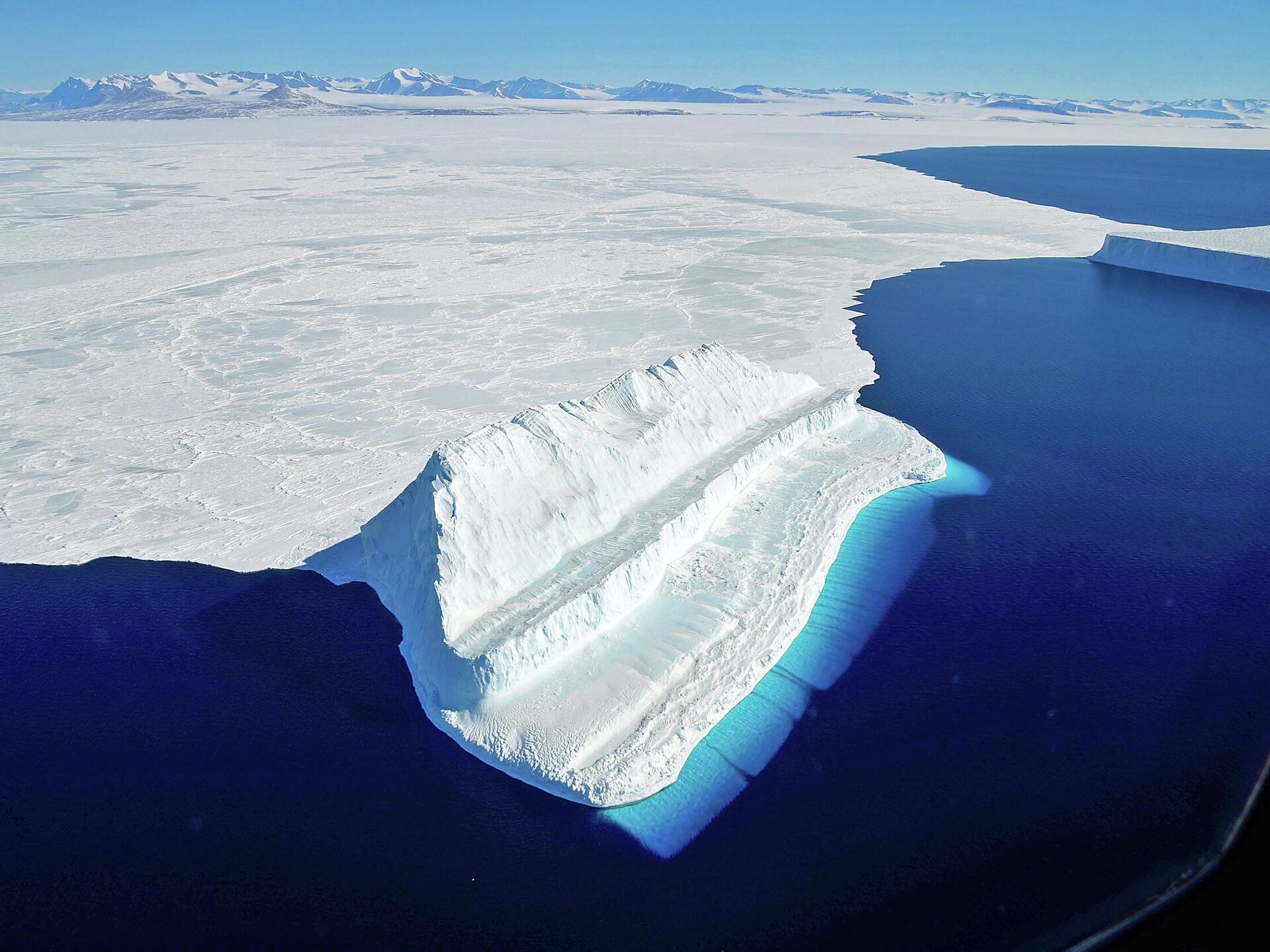
Scientists might be getting closer to an understanding of how the Antarctica and its underground waters are responding - or even contributing - to climate change.
Over the course of recent years, scientists have discovered a network of rivers and lakes that exist within the Antarctic ice, while also imaging thick basins of sediments under the ice that could potentially contain the biggest water reservoir on the planet, according to a new
study.
The findings resulted in scientists piecing together a huge map of the groundwater system in deep sediments in West Antarctica. Such systems may indicate the continent's response to climate change, or even how it might contribute to it.
"Our data reveal a volume of groundwater within [some] 1-kilometre-thick sedimentary basin that is more than an order of magnitude larger than the known subglacial system," the authors of the study wrote. "A vertical salinity gradient indicates exchange between paleo seawater at depth and contemporary basal meltwater above. Our results provide new constraints for subglacial water systems that affect ice streaming and subglacial biogeochemical processes."
Before the study, evidence pointing to the fact that there is a massive groundwater reservoir below the Antarctic ice had been quite elusive. But the new findings seem to have changed the picture.
“The amount of groundwater we found was so significant, it likely influences ice-stream processes. Now we have to find out more and figure out how to incorporate that into models," he study’s lead author, Chloe Gustafson of Columbia University, told
SciTechDaily.
In order to map the groundwater systems in Antarctica, the researchers behind the study used magnetotelluric and passive seismic data from the Whillans Ice Stream of West Antarctica. The technique of magnetotelluric imaging measures the penetration into the earth of natural electromagnetic energy generated high in the planet’s atmosphere. Ice, sediments, salty water and other things emanate different types of such energy, so, having measured the differences, one could create MRI-like maps of various elements.
"This groundwater, extending downward for more than a kilometre, contains more than 10 times as much fluid volume as the shallow hydrologic system above and actively exchanges with it. Therefore, it has the potential to modulate ice streaming and subglacial biogeochemical reactions," the study's abstract notes.


