https://sputnikglobe.com/20220103/china-builds-bridge-across-pangong-lake-to-speed-up-troop-movements-near-indias-military-posts-1091993797.html
China Builds Bridge Across Pangong Lake to Speed Up Troop Movements Near India's Military Posts
China Builds Bridge Across Pangong Lake to Speed Up Troop Movements Near India's Military Posts
Sputnik International
Pangong Tso [Lake] was one of several friction points along the loosely demarcated Line of Actual Control (LAC) where India's Army and China's People's... 03.01.2022, Sputnik International
2022-01-03T14:17+0000
2022-01-03T14:17+0000
2022-07-19T10:41+0000
tibet
chinese people's liberation army (pla)
ladakh standoff
china
indian army
border tensions
https://cdn1.img.sputnikglobe.com/img/105677/33/1056773333_0:0:4608:2592_1920x0_80_0_0_17f7723b31a4d402aadb028db1bd0f1c.jpg
The People's Liberation Army has started building a bridge across Pangong Lake to cut the time it takes to reach Indian military posts at the lake's southern bank.By having this bridge, the PLA is hoping to prevent the Indian Army from repeating "Operation Snow Leopard" which occurred in August 2020 to capture dominating heights in the southern bank of the 135km lake shared between India and China in Eastern Ladakh. Under this operation, India took control of vantage points such as Black Top, Helmet Top, Rechin-la and Rezang-La of the Kailash ranges. This gave India domination of the whole of the Pangong area."The Chinese were taken aback by the swift movement and build-up (on the southern bank of Pangong) …They have probably learnt the lesson, and since they are quick in taking remedial measures, several steps have been initiated to ensure that their movement through that area is quicker and they have the ability to scale up presence in a big way," a source told news outlet The Print, explaining the reason for the bridge's construction.The unnamed official said that after the bridge is completed, the distance between Khurnak (Northern Bank) and Rudok (Southern Bank) will be reduced to between 40km and 50-km rather than the 200km it is now. In the absence of the bridge across the lake, the Chinese troops have to cover a longer route to reach the southern bank of Pangong Tso. Satellite imagery shows the bridge is almost completed across a narrow part of the lake.China has several military posts near Khurnak, including Nyagzu and Dambuguru, which the PLA built in 1961.China had withdrawn more than 10,000 troops and over 300 tanks from the Pangong Lake area after the disengagement agreement of 10 February 2021. Pangong Tso is located in Eastern Ladakh, marked by checkpoints 1 through 8, known as "Fingers" as the spurs of the mountain range on the northern bank of Pangong Tso jut out towards the lake like a palm, with the protrusions looking like fingers.India controls the western portion of the 45km lake, and the rest is controlled by China. Both the countries have stopped patrolling between Finger 4 and Finger 8 of Pangong Tso under the disengagement agreement of 10 February 2021.However, unconfirmed satellite imagery in October 2021 shows that PLA Ground Force elements remain forward on the Sirjap, Khurnak Fort, and Nyagzu areas, among others.Last month, India's Defence Minister Rajnath Singh inaugurated 27 new roads and bridges near the China border.Singh also mentioned that "in today's uncertain environment, the possibility of any kind of conflict cannot be ruled out".In May 2020, India and China accused each other of launching several incursions across the Line of Actual Control (LAC). Despite 13 rounds of talks at military commanders' level since June 2020, both sides reinforced their positions with tens of thousands of troops and military assets in the western sector of the LAC.
https://sputnikglobe.com/20210525/indias-intel-report-suggests-china-testing-new-uavs-for-plateau-operations-around-pangong-lake-1082988094.html
tibet
ladakh standoff
china
Sputnik International
feedback@sputniknews.com
+74956456601
MIA „Rosiya Segodnya“
2022
Rishikesh Kumar
https://cdn1.img.sputnikglobe.com/img/07e4/08/04/1080055820_0:0:388:389_100x100_80_0_0_40018ee210946d65d49ffba4f4c008e1.jpg
Rishikesh Kumar
https://cdn1.img.sputnikglobe.com/img/07e4/08/04/1080055820_0:0:388:389_100x100_80_0_0_40018ee210946d65d49ffba4f4c008e1.jpg
News
en_EN
Sputnik International
feedback@sputniknews.com
+74956456601
MIA „Rosiya Segodnya“
Sputnik International
feedback@sputniknews.com
+74956456601
MIA „Rosiya Segodnya“
Rishikesh Kumar
https://cdn1.img.sputnikglobe.com/img/07e4/08/04/1080055820_0:0:388:389_100x100_80_0_0_40018ee210946d65d49ffba4f4c008e1.jpg
tibet, chinese people's liberation army (pla), ladakh standoff, china, indian army, border tensions
tibet, chinese people's liberation army (pla), ladakh standoff, china, indian army, border tensions
China Builds Bridge Across Pangong Lake to Speed Up Troop Movements Near India's Military Posts
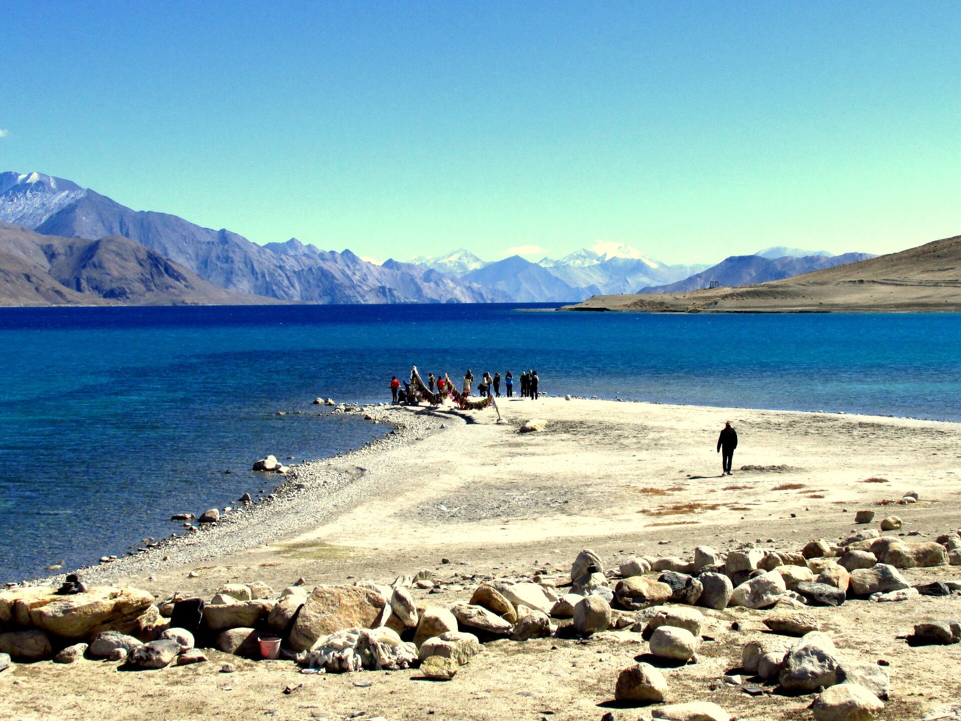
14:17 GMT 03.01.2022 (Updated: 10:41 GMT 19.07.2022) Pangong Tso [Lake] was one of several friction points along the loosely demarcated Line of Actual Control (LAC) where India's Army and China's People's Liberation Army clashed with stones and iron rods in 2020. In February 2021, the two countries reached an agreement to withdraw troops from the lake and halt patrolling.
The People's Liberation Army has started building a bridge across Pangong Lake to cut the time it takes to reach Indian military posts at the lake's southern bank.
By having this bridge, the PLA is hoping to prevent the Indian Army from repeating
"Operation Snow Leopard" which occurred in August 2020 to capture dominating heights in the southern bank of the 135km lake shared between India and China in Eastern Ladakh.
Under this operation, India took control of vantage points such as Black Top, Helmet Top, Rechin-la and Rezang-La of the Kailash ranges. This gave India domination of the whole of the Pangong area.
"The Chinese were taken aback by the swift movement and build-up (on the southern bank of Pangong) …They have probably learnt the lesson, and since they are quick in taking remedial measures, several steps have been initiated to ensure that their movement through that area is quicker and they have the ability to scale up presence in a big way," a source told news outlet The Print, explaining the reason for the bridge's construction.
The unnamed official said that after the bridge is completed, the distance between Khurnak (Northern Bank) and Rudok (Southern Bank) will be reduced to between 40km and 50-km rather than the 200km it is now.
In the absence of the bridge across the lake, the Chinese troops have to cover a longer route to reach the southern bank of Pangong Tso.
Satellite imagery shows the bridge is almost completed across a narrow part of the lake.
China has several military posts near Khurnak, including Nyagzu and Dambuguru, which the PLA built in 1961.
China had withdrawn more than
10,000 troops and over 300 tanks from the Pangong Lake area after the disengagement agreement of 10 February 2021.
Pangong Tso is located in Eastern Ladakh, marked by checkpoints 1 through 8, known as "Fingers" as the spurs of the mountain range on the northern bank of Pangong Tso jut out towards the lake like a palm, with the protrusions looking like fingers.
India controls the western portion of the 45km lake, and the rest is controlled by China. Both the countries have stopped patrolling between Finger 4 and Finger 8 of Pangong Tso under the disengagement agreement of 10 February 2021.
However,
unconfirmed satellite imagery in October 2021 shows that PLA Ground Force elements remain forward on the Sirjap, Khurnak Fort, and Nyagzu areas, among others.
Last month, India's Defence Minister Rajnath Singh inaugurated 27 new roads and bridges near the China border.
Singh also mentioned that "in today's uncertain environment, the possibility of any kind of conflict cannot be ruled out".
In May 2020, India and China accused each other of launching several incursions across the Line of Actual Control (LAC).
Despite 13 rounds of talks at military commanders' level since June 2020, both sides reinforced their positions with tens of thousands of troops and military assets in the western sector of the LAC.


