
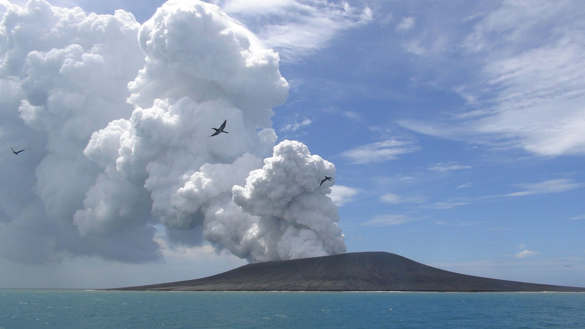
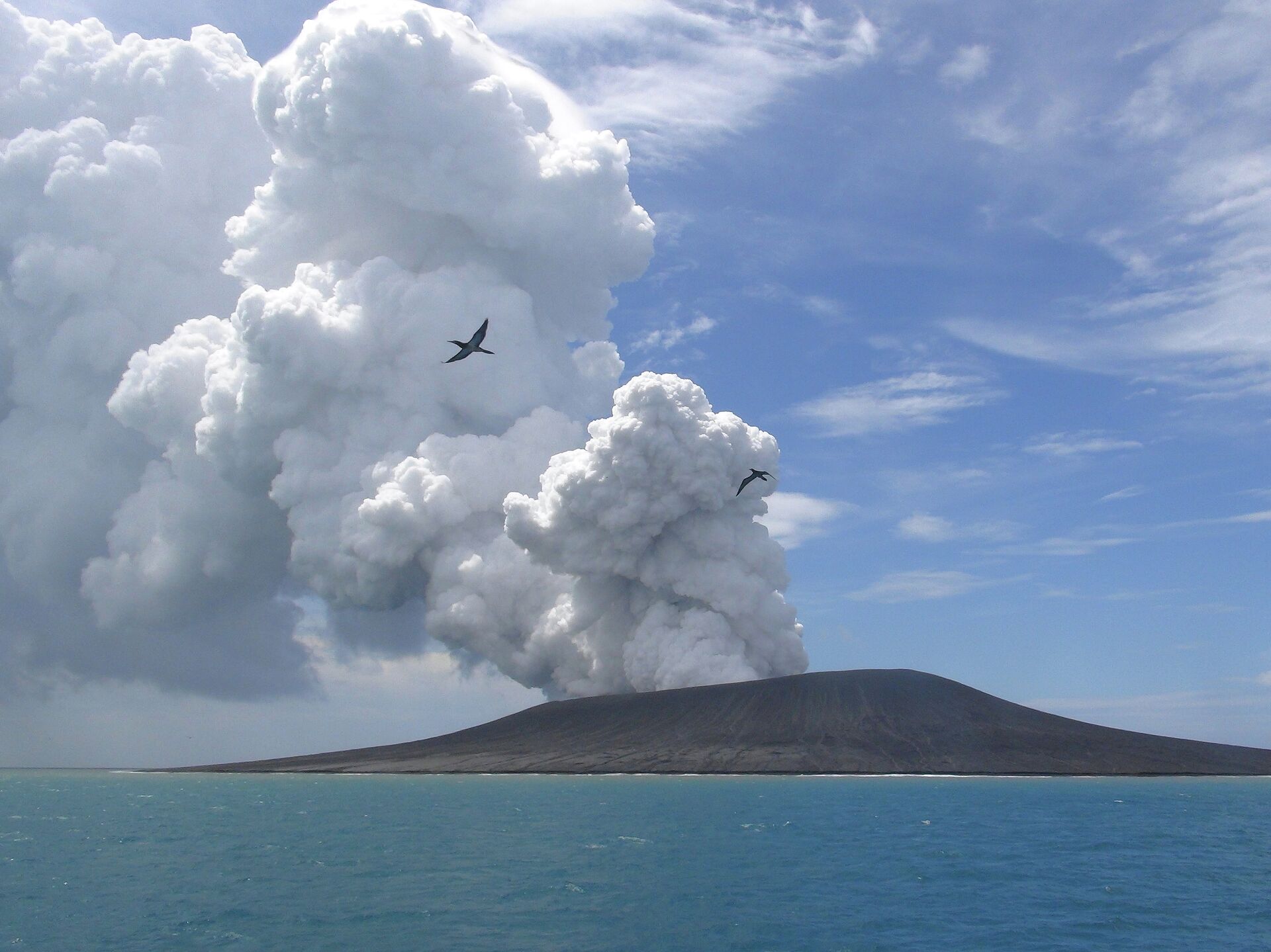
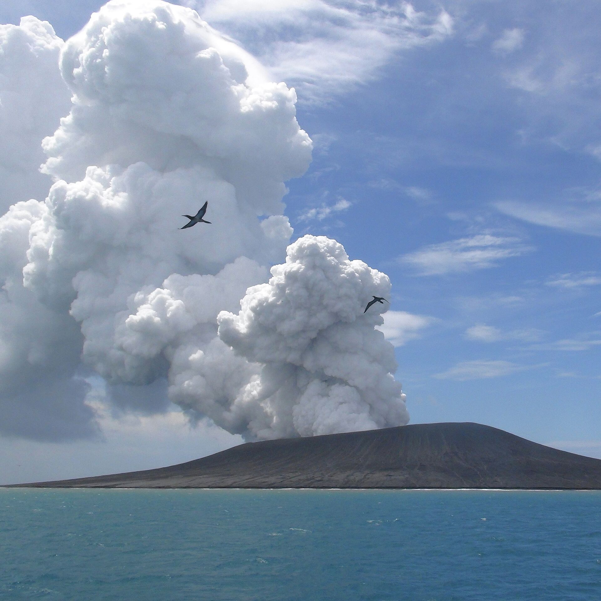
Satellite images released earlier this week depict the gradual emergence of the new Lateiki Island, which is 3 times bigger than the original one. According media outlet Matangi Tonga, the latest eruption was first reported to the Tonga Meteorological Services (TMS) at Fua’amotu on the morning of 14 October by the Tongan vessel MV Ngutulei.
Since mid-Oct we’ve been tracking the #Lateiki (#Metis Shoal) #eruption with satellite imagery. By Nov 1 an elongated island has appeared at the main focus of activity. In the right most image we have combined the 1st and last images showing the 1995 dome appears to have gone. pic.twitter.com/tSukPm6car
— GeoNet (@geonet) November 4, 2019
The media outlet said that further reports and data on the 'growing' new volcanic island were made with the assistance of New Zealand aircraft.
The Kingdom of Tonga is an archipelago of about 170 islands in the South Pacific Ocean, located in a seismically active zone known as the Ring of Fire that regularly suffers from powerful earthquakes and volcanic eruptions.
Before last month, the most recent emergence of an island in Tonga was registered in 2015. An undersea volcanic eruption, which reportedly lasted for about a month and disrupted local air traffic, created a new island measuring about 1.8 kilometers (1.1 miles) by 1.5 kilometers (0.9 miles).
New islands can emerge as a result of various natural mechanisms such as erosion, volcanic eruption or glacial retreat. One of the most prominent volcanic islands is the island of Surtsey, located off the southern coast of Iceland. Surtsey emerged in 1963, also as a result of an undersea volcanic eruption.


