
October 24 is considered to be the birthday of astrophotography. Seventy years ago on this day, the first picture of the Earth from space was taken. By modern standards, its quality was not exactly the best. Since then, technology has leapt forward, allowing for the beauty of our planet to be captured in all its glory.

1/21
© Photo : Public domain
The first photo taken from space on October 24, 1946, on the sub-orbital US-launched V-2 rocket (flight #13) at White Sands Missile Range. Photos were taken every second and a half. The highest altitude (65 miles, 105 km) was 5 times higher than any picture taken before.

An image of Earth taken from space by American astronaut Scott Kelly on board the ISS.

The Operational Land Imager (OLI) on NASA's Landsat 8 satellite acquired this large natural-color image showing a view of the Caspian Sea around the Tyuleniy Archipelago on April 16, 2016. Ocean scientist Norman Kuring of NASA’s Goddard Space Flight Center found a puzzling feature in the image – lines crisscrossing the North Caspian Sea. On its own, the image was strikingly beautiful. Shallow waters surrounding the Tyuleniy Archipelago allow you to see the dark green vegetation on the sea bottom. But the question remained: what caused those lines?

A view of the Yukon Delta National Wildlife Refuge in Alaska seen from space.

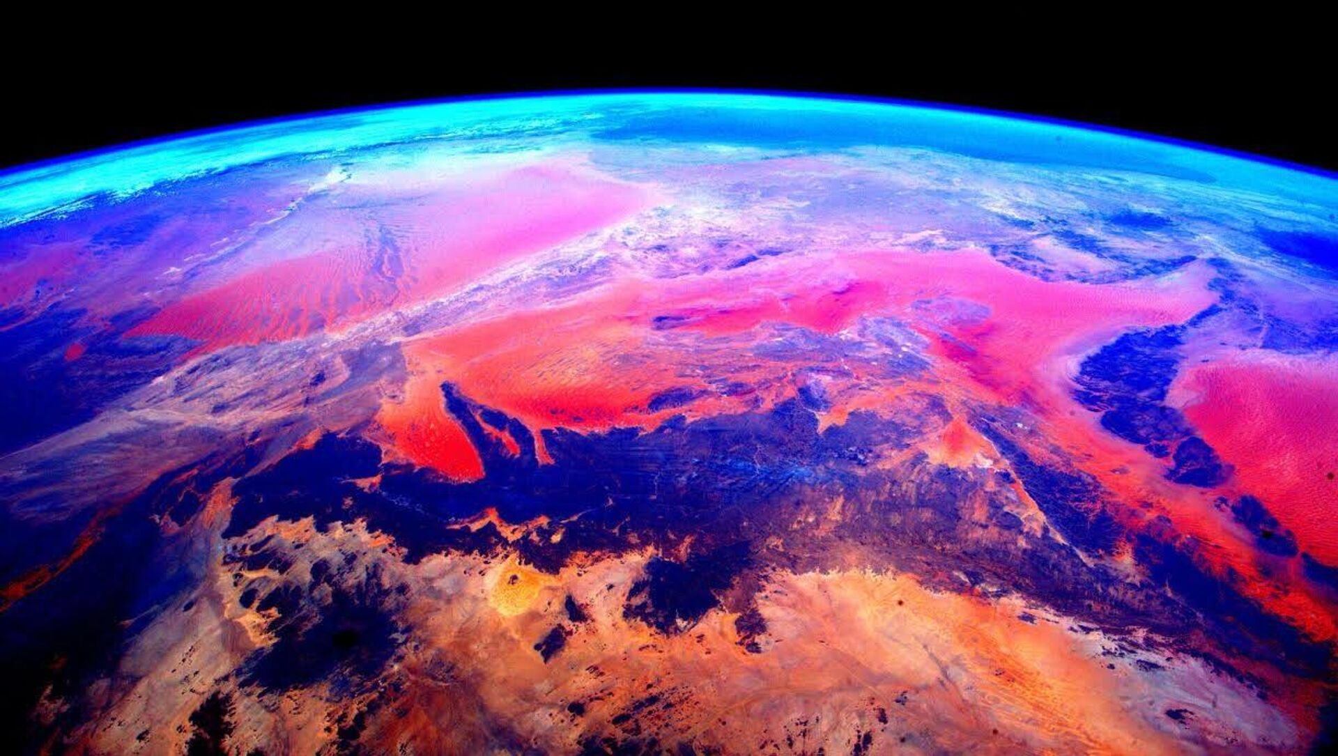
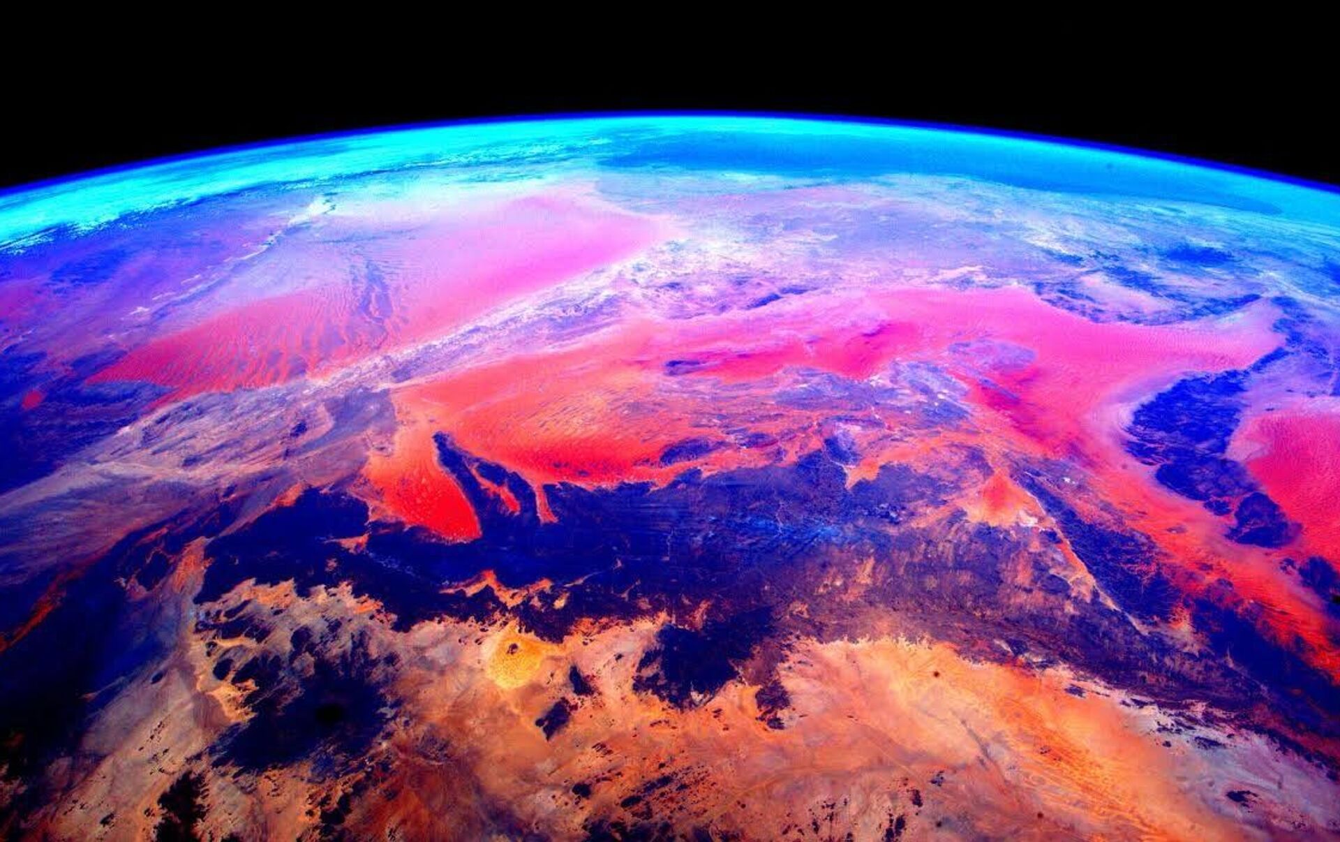
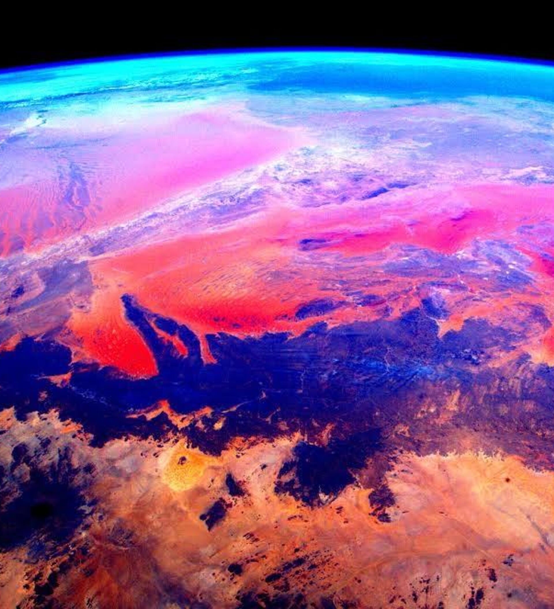
A snapshot of Australia made from space by American astronaut Scott Kelly on board the ISS.

The first man-made picture of the Earth taken from space by Soviet cosmonaut German Titov in 1961.

An image of Earth taken from space by American astronaut Scott Kelly.

A photo of the exotic islands in the Caribbean taken from the ISS by Russian cosmonaut Sergei Volkov.

Small, blocky shapes of towns, fields, and pastures surround the graceful swirls and whorls of the Mississippi River, the largest river system in North America. Countless oxbow lakes and cutoffs accompany the meandering river south of Memphis, Tennessee, on the border between Arkansas and Mississippi.

An astronaut aboard the ISS took this photograph of small island cays in the Bahamas and the prominent tidal channels cutting between them. For astronauts, this is one of the most recognizable points on the planet.

A photo of Earth taken from the ISS using slow shutter speed.

EarthArt in one pass over the Australian continent.

Although it may look like a watercolor painting, this image is a natural-color capture of a plankton bloom in the Barents Sea by the Sentinel-2A, a European optical imaging satellite launched in 2015. Plankton, the most abundant type of life found in the ocean, are microscopic marine plants that drift on or near the surface of the sea.

An image of Earth taken from space by American astronaut Scott Kelly on board the ISS.

A space view of Africa observed from the International Space Station.

Stunning dancing lights of an aurora captured from the ISS. Auroras are space weather phenomena that occur when electrically-charged electrons and protons collide with neutral atoms in the upper atmosphere.

In the style of Van Gogh's painting "Starry Night," massive congregations of greenish phytoplankton swirl in the dark water around Gotland, a Swedish island in the Baltic Sea. Phytoplankton are microscopic marine plants that form the first link in nearly all ocean food chains. Population explosions, or blooms, of phytoplankton, like the one shown here, occur when deep currents bring nutrients up to sunlit surface waters, fueling the growth and reproduction of these tiny plants.

A snapshot of Africa made by American astronaut Scott Kelly on board the ISS.

The southern-central edge of the Tibetan Plateau near the border with western Nepal and the Indian state of Sikkim is pictured in this Sentinel-2A image from February 1, 2016. With an average elevation exceeding 4500 meters and an area of 2.5 million square kilometers, it is the highest and largest plateau in the world today. The plateau is also the world’s third largest store of ice, after the Arctic and Antarctic.

An image of the Lake Tengiz in Kazakhstan taken from space by American astronaut Scott Kelly on board the ISS.

What look like abstract pale yellow paint streaks slashing through a mosaic of mottled colors are ridges of wind-blown sand that make up Erg Iguidi, an area of ever-shifting sand dunes extending from Algeria into Mauritania in northwestern Africa.


