https://sputnikglobe.com/20220219/volcanic-eruption-in-tonga-produced-tallest-ash-plume-ever-to-spotted-by-satellites--nasa-1093184843.html
Volcanic Eruption in Tonga Produced Tallest Ash Plume Ever Imaged by Satellites – NASA
Volcanic Eruption in Tonga Produced Tallest Ash Plume Ever Imaged by Satellites – NASA
Sputnik International
The ash expelled into the air reached a height of 56 kilometres, with the resulting plume much bigger than the 36-kilometre0tall one produced by the Mount... 19.02.2022, Sputnik International
2022-02-19T18:48+0000
2022-02-19T18:48+0000
2022-02-19T19:27+0000
world
nasa
volcano
eruption
ash
https://cdn1.img.sputnikglobe.com/img/07e6/01/0f/1092281169_0:70:3000:1758_1920x0_80_0_0_c385ea247e9df099931b1ed91bc1e3f1.jpg
The underwater volcano's eruption that occurred in January near the uninhabited island of Hunga Tonga-Hunga Ha'apai apparently sent into the atmosphere the highest ash plume to be detected by satellites, NASA says.According to the space agency, the eruption – the largest “since satellites began monitoring our planet” – was monitored by the National Atmospheric and Oceanic Administration's Geostationary Operational Environmental Satellite 17 (GOES-17) and the Japanese Aerospace Exploration Agency’s 's Himawari-8 satellites.Having analysed the data obtained, scientists at NASA’s Langley Research Centre concluded that the plume from this volcanic eruption was 56 kilometres tall at its highest point, reaching the mesosphere; for comparison, the ash plume produced by the Mount Pinatubo eruption in 1991 rose “only” 35 kilometres into the air.“The intensity of this event far exceeds that of any storm cloud I have ever studied,” said Kristopher Bedka, an atmospheric scientist at NASA Langley. “We are fortunate that it was viewed so well by our latest generation of geostationary satellites and we can use this data in innovative ways to document its evolution.”
Sputnik International
feedback@sputniknews.com
+74956456601
MIA „Rosiya Segodnya“
2022
News
en_EN
Sputnik International
feedback@sputniknews.com
+74956456601
MIA „Rosiya Segodnya“
Sputnik International
feedback@sputniknews.com
+74956456601
MIA „Rosiya Segodnya“
nasa, volcano, eruption, ash
nasa, volcano, eruption, ash
Volcanic Eruption in Tonga Produced Tallest Ash Plume Ever Imaged by Satellites – NASA
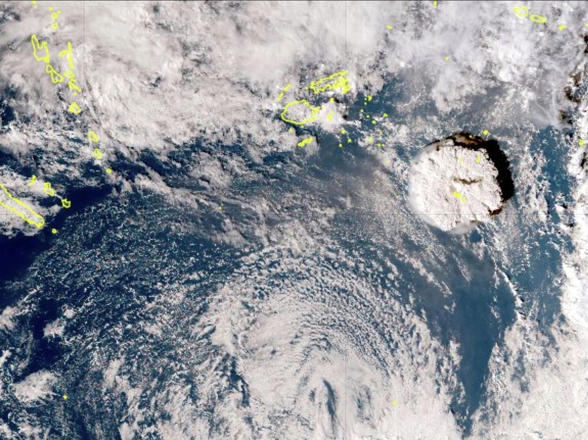
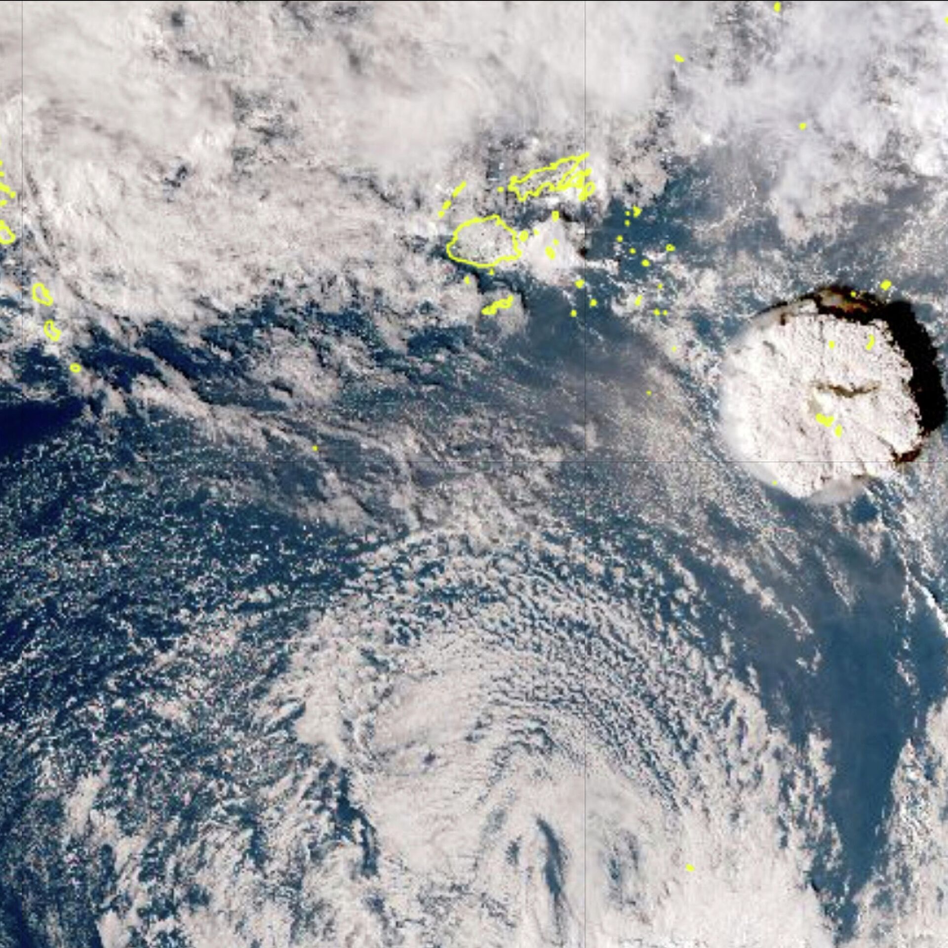
18:48 GMT 19.02.2022 (Updated: 19:27 GMT 19.02.2022) The ash expelled into the air reached a height of 56 kilometres, with the resulting plume much bigger than the 36-kilometre0tall one produced by the Mount Pinatubo eruption in 1991.
The underwater volcano's eruption that occurred in January near the uninhabited island of Hunga Tonga-Hunga Ha'apai apparently sent into the atmosphere the highest ash plume to be detected by satellites, NASA says.
According to the space agency, the eruption – the largest “since satellites began monitoring our planet” – was monitored by the National Atmospheric and Oceanic Administration's Geostationary Operational Environmental Satellite 17 (GOES-17) and the Japanese Aerospace Exploration Agency’s 's Himawari-8 satellites.
Having analysed the data obtained, scientists at NASA’s Langley Research Centre concluded that the plume from this volcanic eruption was 56 kilometres tall at its highest point, reaching the mesosphere; for comparison, the ash plume produced by the Mount Pinatubo eruption in 1991 rose “only” 35 kilometres into the air.
“The intensity of this event far exceeds that of any storm cloud I have ever studied,” said Kristopher Bedka, an atmospheric scientist at NASA Langley. “We are fortunate that it was viewed so well by our latest generation of geostationary satellites and we can use this data in innovative ways to document its evolution.”


